Property/Postcode Data Search:
AL8 7DU maps, stats, and open data
AL8 7DU is located in the Sherrards electoral ward, within the local authority district of Welwyn Hatfield and the English Parliamentary constituency of Welwyn Hatfield. The Sub Integrated Care Board (ICB) Location is NHS Hertfordshire and West Essex ICB - 06K and the police force is Hertfordshire. This postcode has been in use since December 2019.
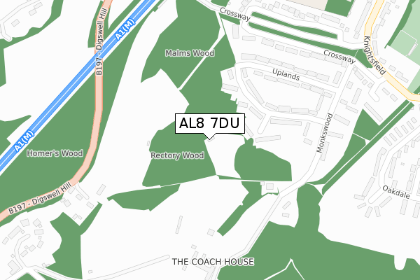
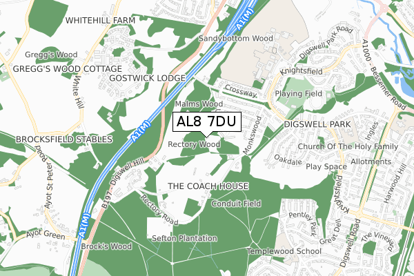
AL8 7DU maps


Source: OS Open Zoomstack (Ordnance Survey)
Licence: Open Government Licence (requires attribution)
Attribution: Contains OS data © Crown copyright and database right 2025
Source: Open Postcode Geo
Licence: Open Government Licence (requires attribution)
Attribution: Contains OS data © Crown copyright and database right 2025; Contains Royal Mail data © Royal Mail copyright and database right 2025; Source: Office for National Statistics licensed under the Open Government Licence v.3.0
Licence: Open Government Licence (requires attribution)
Attribution: Contains OS data © Crown copyright and database right 2025
Source: Open Postcode Geo
Licence: Open Government Licence (requires attribution)
Attribution: Contains OS data © Crown copyright and database right 2025; Contains Royal Mail data © Royal Mail copyright and database right 2025; Source: Office for National Statistics licensed under the Open Government Licence v.3.0
AL8 7DU geodata
| Easting | 523071 |
| Northing | 214600 |
| Latitude | 51.816494 |
| Longitude | -0.215939 |
Where is AL8 7DU?
| Country | England |
| Postcode District | AL8 |
Politics
| Ward | Sherrards |
|---|---|
| Constituency | Welwyn Hatfield |
Transport
Nearest bus stops to AL8 7DU
| Uplands | Digswell Park | 251m |
| Oakdale (Knightsfield) | Digswell Park | 472m |
| Oakdale (Knightsfield) | Digswell Park | 497m |
| Monks Walk School (Knightsfield) | Digswell Park | 529m |
| Monks Walk School (Knightsfield) | Digswell Park | 588m |
Nearest railway stations to AL8 7DU
| Welwyn North Station | 1.8km |
| Welwyn Garden City Station | 1.9km |
Deprivation
7.7% of English postcodes are less deprived than AL8 7DU:Food Standards Agency
Three nearest food hygiene ratings to AL8 7DU (metres)
Monks Walk School

Knightsfield
490m
Digswell Park Sports Association

288 Knightsfield
516m
The Red Lion

11 Digswell Hill
815m
➜ Get more ratings from the Food Standards Agency
Nearest post box to AL8 7DU
| Last Collection | |||
|---|---|---|---|
| Location | Mon-Fri | Sat | Distance |
| Crossways | 17:00 | 12:00 | 406m |
| Pentley Park | 16:00 | 10:30 | 730m |
| Norman Road | 17:00 | 12:00 | 758m |
AL8 7DU ITL and AL8 7DU LAU
The below table lists the International Territorial Level (ITL) codes (formerly Nomenclature of Territorial Units for Statistics (NUTS) codes) and Local Administrative Units (LAU) codes for AL8 7DU:
| ITL 1 Code | Name |
|---|---|
| TLH | East |
| ITL 2 Code | Name |
| TLH2 | Bedfordshire and Hertfordshire |
| ITL 3 Code | Name |
| TLH23 | Hertfordshire CC |
| LAU 1 Code | Name |
| E07000241 | Welwyn Hatfield |
AL8 7DU census areas
The below table lists the Census Output Area (OA), Lower Layer Super Output Area (LSOA), and Middle Layer Super Output Area (MSOA) for AL8 7DU:
| Code | Name | |
|---|---|---|
| OA | E00121667 | |
| LSOA | E01023962 | Welwyn Hatfield 003D |
| MSOA | E02004982 | Welwyn Hatfield 003 |
Nearest postcodes to AL8 7DU
| AL8 7EJ | Holly Walk | 117m |
| AL8 7EL | Mayfield | 134m |
| AL8 7EQ | Uplands | 151m |
| AL8 7EH | Uplands | 171m |
| AL8 7EN | Uplands | 243m |
| AL8 7EW | Uplands | 252m |
| AL8 7EG | Monkswood | 265m |
| AL8 7ED | Crossway | 283m |
| AL8 7SU | Digswell Place | 300m |
| AL8 7EF | Monkswood | 313m |