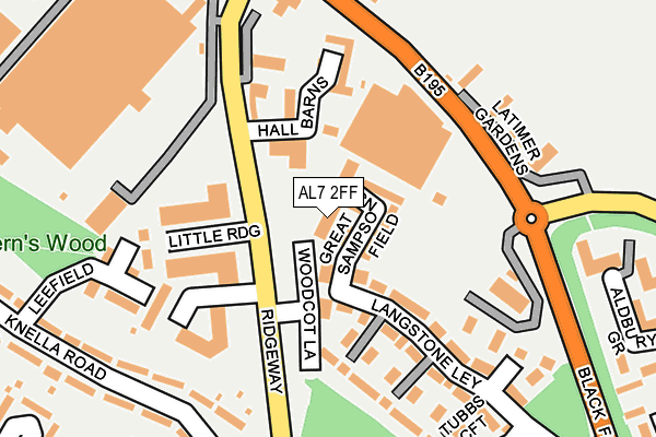
AL7 2FF is located in the Panshanger electoral ward, within the local authority district of Welwyn Hatfield and the English Parliamentary constituency of Welwyn Hatfield. The Sub Integrated Care Board (ICB) Location is NHS Hertfordshire and West Essex ICB - 06K and the police force is Hertfordshire. This postcode has been in use since March 2017.


GetTheData
Source: OS OpenMap – Local (Ordnance Survey)
Source: OS VectorMap District (Ordnance Survey)
Licence: Open Government Licence (requires attribution)
| Easting | 526584 |
| Northing | 212848 |
| Latitude | 51.799965 |
| Longitude | -0.165640 |
GetTheData
Source: Open Postcode Geo
Licence: Open Government Licence
| Country | England |
| Postcode District | AL7 |
➜ See where AL7 is on a map ➜ Where is Welwyn Garden City? | |
GetTheData
Source: Land Registry Price Paid Data
Licence: Open Government Licence
| Ward | Panshanger |
| Constituency | Welwyn Hatfield |
GetTheData
Source: ONS Postcode Database
Licence: Open Government Licence
| Wyton (Shackleton Way) | Panshanger | 74m |
| Lincoln Close (Bericot Way) | Panshanger | 122m |
| Wellington Drive (Bericot Way) | Panshanger | 152m |
| Chedburgh (Lysander Way) | Panshanger | 232m |
| Russett Wood (Sylvan Way) | Panshanger | 338m |
| Welwyn Garden City Station | 2.7km |
| Welwyn North Station | 3.2km |
| Hatfield (Herts) Station | 5.3km |
GetTheData
Source: NaPTAN
Licence: Open Government Licence
| Percentage of properties with Next Generation Access | 100.0% |
| Percentage of properties with Superfast Broadband | 100.0% |
| Percentage of properties with Ultrafast Broadband | 100.0% |
| Percentage of properties with Full Fibre Broadband | 0.0% |
Superfast Broadband is between 30Mbps and 300Mbps
Ultrafast Broadband is > 300Mbps
| Percentage of properties unable to receive 2Mbps | 0.0% |
| Percentage of properties unable to receive 5Mbps | 0.0% |
| Percentage of properties unable to receive 10Mbps | 0.0% |
| Percentage of properties unable to receive 30Mbps | 0.0% |
GetTheData
Source: Ofcom
Licence: Ofcom Terms of Use (requires attribution)
GetTheData
Source: ONS Postcode Database
Licence: Open Government Licence


➜ Get more ratings from the Food Standards Agency
GetTheData
Source: Food Standards Agency
Licence: FSA terms & conditions
| Last Collection | |||
|---|---|---|---|
| Location | Mon-Fri | Sat | Distance |
| Berricott Way | 17:30 | 12:00 | 154m |
| Lysander Way | 17:30 | 12:00 | 365m |
| Panshanger | 17:30 | 11:45 | 515m |
GetTheData
Source: Dracos
Licence: Creative Commons Attribution-ShareAlike
The below table lists the International Territorial Level (ITL) codes (formerly Nomenclature of Territorial Units for Statistics (NUTS) codes) and Local Administrative Units (LAU) codes for AL7 2FF:
| ITL 1 Code | Name |
|---|---|
| TLH | East |
| ITL 2 Code | Name |
| TLH2 | Bedfordshire and Hertfordshire |
| ITL 3 Code | Name |
| TLH23 | Hertfordshire CC |
| LAU 1 Code | Name |
| E07000241 | Welwyn Hatfield |
GetTheData
Source: ONS Postcode Directory
Licence: Open Government Licence
The below table lists the Census Output Area (OA), Lower Layer Super Output Area (LSOA), and Middle Layer Super Output Area (MSOA) for AL7 2FF:
| Code | Name | |
|---|---|---|
| OA | E00121612 | |
| LSOA | E01023950 | Welwyn Hatfield 005A |
| MSOA | E02004984 | Welwyn Hatfield 005 |
GetTheData
Source: ONS Postcode Directory
Licence: Open Government Licence
| AL7 2PF | Wyton | 111m |
| AL7 2PD | Stapleford | 112m |
| AL7 2NJ | Wellington Drive | 121m |
| AL7 2NN | Lincoln Close | 135m |
| AL7 2PT | Waterbeach | 147m |
| AL7 2NG | Beverley Gardens | 153m |
| AL7 2PE | Wyton | 168m |
| AL7 2PB | Tempsford | 176m |
| AL7 2PL | Rivenhall End | 186m |
| AL7 2NQ | Lindbergh | 190m |
GetTheData
Source: Open Postcode Geo; Land Registry Price Paid Data
Licence: Open Government Licence