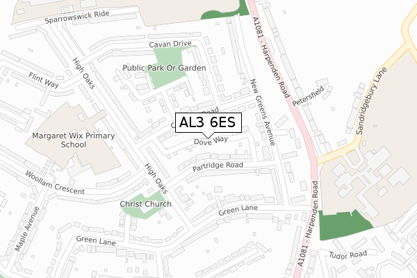
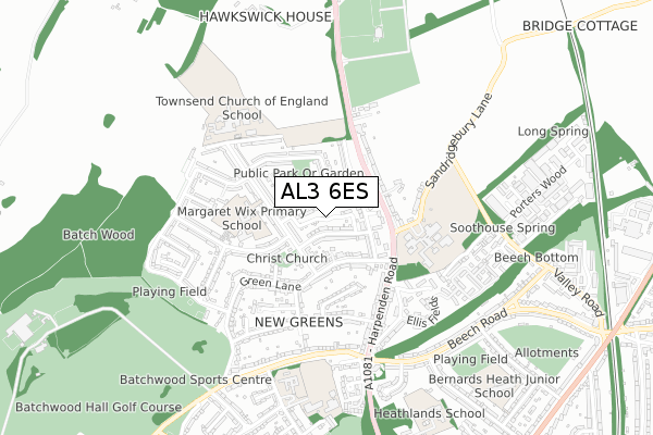
AL3 6ES is located in the Batchwood electoral ward, within the local authority district of St Albans and the English Parliamentary constituency of St Albans. The Sub Integrated Care Board (ICB) Location is NHS Hertfordshire and West Essex ICB - 06N and the police force is Hertfordshire. This postcode has been in use since June 2018.


GetTheData
Source: OS Open Zoomstack (Ordnance Survey)
Licence: Open Government Licence (requires attribution)
Attribution: Contains OS data © Crown copyright and database right 2025
Source: Open Postcode Geo
Licence: Open Government Licence (requires attribution)
Attribution: Contains OS data © Crown copyright and database right 2025; Contains Royal Mail data © Royal Mail copyright and database right 2025; Source: Office for National Statistics licensed under the Open Government Licence v.3.0
| Easting | 514800 |
| Northing | 209318 |
| Latitude | 51.770781 |
| Longitude | -0.337620 |
GetTheData
Source: Open Postcode Geo
Licence: Open Government Licence
| Country | England |
| Postcode District | AL3 |
➜ See where AL3 is on a map ➜ Where is St Albans? | |
GetTheData
Source: Land Registry Price Paid Data
Licence: Open Government Licence
| Ward | Batchwood |
| Constituency | St Albans |
GetTheData
Source: ONS Postcode Database
Licence: Open Government Licence
| Blundell Close (Carnegie Road) | New Greens | 112m |
| High Oaks Terminus (High Oaks) | New Greens | 198m |
| High Oaks Terminus (High Oaks) | New Greens | 210m |
| St Albans Girls School (Harpenden Road) | New Greens | 230m |
| Cavan Drive | New Greens | 246m |
| St Albans City Station | 2.4km |
| St Albans Abbey Station | 2.9km |
| Harpenden Station | 5km |
GetTheData
Source: NaPTAN
Licence: Open Government Licence
| Percentage of properties with Next Generation Access | 100.0% |
| Percentage of properties with Superfast Broadband | 100.0% |
| Percentage of properties with Ultrafast Broadband | 0.0% |
| Percentage of properties with Full Fibre Broadband | 0.0% |
Superfast Broadband is between 30Mbps and 300Mbps
Ultrafast Broadband is > 300Mbps
| Median download speed | 39.1Mbps |
| Average download speed | 30.1Mbps |
| Maximum download speed | 80.00Mbps |
| Median upload speed | 9.8Mbps |
| Average upload speed | 7.7Mbps |
| Maximum upload speed | 20.00Mbps |
| Percentage of properties unable to receive 2Mbps | 0.0% |
| Percentage of properties unable to receive 5Mbps | 0.0% |
| Percentage of properties unable to receive 10Mbps | 0.0% |
| Percentage of properties unable to receive 30Mbps | 0.0% |
GetTheData
Source: Ofcom
Licence: Ofcom Terms of Use (requires attribution)
GetTheData
Source: ONS Postcode Database
Licence: Open Government Licence


➜ Get more ratings from the Food Standards Agency
GetTheData
Source: Food Standards Agency
Licence: FSA terms & conditions
| Last Collection | |||
|---|---|---|---|
| Location | Mon-Fri | Sat | Distance |
| High Oaks P.o | 16:00 | 12:15 | 151m |
| Beech Bottom | 16:00 | 12:00 | 428m |
| Beech Road | 17:30 | 12:00 | 700m |
GetTheData
Source: Dracos
Licence: Creative Commons Attribution-ShareAlike
The below table lists the International Territorial Level (ITL) codes (formerly Nomenclature of Territorial Units for Statistics (NUTS) codes) and Local Administrative Units (LAU) codes for AL3 6ES:
| ITL 1 Code | Name |
|---|---|
| TLH | East |
| ITL 2 Code | Name |
| TLH2 | Bedfordshire and Hertfordshire |
| ITL 3 Code | Name |
| TLH23 | Hertfordshire CC |
| LAU 1 Code | Name |
| E07000240 | St Albans |
GetTheData
Source: ONS Postcode Directory
Licence: Open Government Licence
The below table lists the Census Output Area (OA), Lower Layer Super Output Area (LSOA), and Middle Layer Super Output Area (MSOA) for AL3 6ES:
| Code | Name | |
|---|---|---|
| OA | E00120214 | |
| LSOA | E01023671 | St Albans 009C |
| MSOA | E02004932 | St Albans 009 |
GetTheData
Source: ONS Postcode Directory
Licence: Open Government Licence
| AL3 6HL | Carnegie Road | 44m |
| AL3 6HH | Partridge Road | 84m |
| AL3 6HN | Carnegie Road | 117m |
| AL3 6GY | The Ferns | 122m |
| AL3 6HJ | New Greens Avenue | 130m |
| AL3 6DL | High Oaks | 136m |
| AL3 6HG | Green Lane | 154m |
| AL3 6HQ | New Greens Avenue | 193m |
| AL3 6HP | Cavan Drive | 200m |
| AL3 6EU | Green Lane | 202m |
GetTheData
Source: Open Postcode Geo; Land Registry Price Paid Data
Licence: Open Government Licence