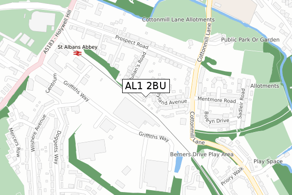
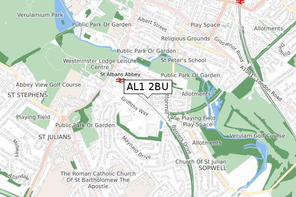
AL1 2BU is located in the Sopwell electoral ward, within the local authority district of St Albans and the English Parliamentary constituency of St Albans. The Sub Integrated Care Board (ICB) Location is NHS Hertfordshire and West Essex ICB - 06N and the police force is Hertfordshire. This postcode has been in use since September 2018.


GetTheData
Source: OS Open Zoomstack (Ordnance Survey)
Licence: Open Government Licence (requires attribution)
Attribution: Contains OS data © Crown copyright and database right 2025
Source: Open Postcode Geo
Licence: Open Government Licence (requires attribution)
Attribution: Contains OS data © Crown copyright and database right 2025; Contains Royal Mail data © Royal Mail copyright and database right 2025; Source: Office for National Statistics licensed under the Open Government Licence v.3.0
| Easting | 514766 |
| Northing | 206249 |
| Latitude | 51.743205 |
| Longitude | -0.339125 |
GetTheData
Source: Open Postcode Geo
Licence: Open Government Licence
| Country | England |
| Postcode District | AL1 |
➜ See where AL1 is on a map ➜ Where is St Albans? | |
GetTheData
Source: Land Registry Price Paid Data
Licence: Open Government Licence
| Ward | Sopwell |
| Constituency | St Albans |
GetTheData
Source: ONS Postcode Database
Licence: Open Government Licence
1, HOLLY CLOSE, ST ALBANS, AL1 2BU 2024 21 FEB £825,000 |
1, HOLLY CLOSE, ST ALBANS, AL1 2BU 2020 30 JUN £600,000 |
GetTheData
Source: HM Land Registry Price Paid Data
Licence: Contains HM Land Registry data © Crown copyright and database right 2025. This data is licensed under the Open Government Licence v3.0.
| Mentmore Road (Cottonmill Lane) | St Albans | 169m |
| Griffiths Way | St Albans | 281m |
| Griffiths Way | St Albans | 289m |
| Wilshere Avenue (Doggetts Way) | St Julians | 296m |
| Wilshere Avenue (Doggetts Way) | St Julians | 307m |
| St Albans Abbey Station | 0.3km |
| St Albans City Station | 1.1km |
| Park Street Station | 2km |
GetTheData
Source: NaPTAN
Licence: Open Government Licence
| Percentage of properties with Next Generation Access | 100.0% |
| Percentage of properties with Superfast Broadband | 100.0% |
| Percentage of properties with Ultrafast Broadband | 0.0% |
| Percentage of properties with Full Fibre Broadband | 0.0% |
Superfast Broadband is between 30Mbps and 300Mbps
Ultrafast Broadband is > 300Mbps
| Percentage of properties unable to receive 2Mbps | 0.0% |
| Percentage of properties unable to receive 5Mbps | 0.0% |
| Percentage of properties unable to receive 10Mbps | 0.0% |
| Percentage of properties unable to receive 30Mbps | 0.0% |
GetTheData
Source: Ofcom
Licence: Ofcom Terms of Use (requires attribution)
GetTheData
Source: ONS Postcode Database
Licence: Open Government Licence


➜ Get more ratings from the Food Standards Agency
GetTheData
Source: Food Standards Agency
Licence: FSA terms & conditions
| Last Collection | |||
|---|---|---|---|
| Location | Mon-Fri | Sat | Distance |
| The Brambles | 17:30 | 12:00 | 153m |
| Dellfield | 17:30 | 12:00 | 506m |
| Cotton Mill Crescent | 18:30 | 12:00 | 564m |
GetTheData
Source: Dracos
Licence: Creative Commons Attribution-ShareAlike
The below table lists the International Territorial Level (ITL) codes (formerly Nomenclature of Territorial Units for Statistics (NUTS) codes) and Local Administrative Units (LAU) codes for AL1 2BU:
| ITL 1 Code | Name |
|---|---|
| TLH | East |
| ITL 2 Code | Name |
| TLH2 | Bedfordshire and Hertfordshire |
| ITL 3 Code | Name |
| TLH23 | Hertfordshire CC |
| LAU 1 Code | Name |
| E07000240 | St Albans |
GetTheData
Source: ONS Postcode Directory
Licence: Open Government Licence
The below table lists the Census Output Area (OA), Lower Layer Super Output Area (LSOA), and Middle Layer Super Output Area (MSOA) for AL1 2BU:
| Code | Name | |
|---|---|---|
| OA | E00120544 | |
| LSOA | E01023741 | St Albans 017E |
| MSOA | E02004940 | St Albans 017 |
GetTheData
Source: ONS Postcode Directory
Licence: Open Government Licence
| AL1 2BD | Leyland Avenue | 67m |
| AL1 2BE | Leyland Avenue | 89m |
| AL1 2AZ | St Julians Road | 91m |
| AL1 2BA | Prospect Road | 147m |
| AL1 2BB | Cottonmill Lane | 148m |
| AL1 2DP | The Brambles | 165m |
| AL1 2AU | Prospect Road | 179m |
| AL1 2BQ | Cottonmill Lane | 185m |
| AL1 2BT | Cottonmill Lane | 195m |
| AL1 1HH | Cottonmill Lane | 211m |
GetTheData
Source: Open Postcode Geo; Land Registry Price Paid Data
Licence: Open Government Licence