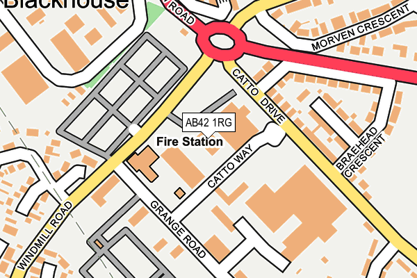
AB42 1RG is located in the Peterhead North and Rattray electoral ward, within the council area of Aberdeenshire and the Scottish Parliamentary constituency of Banff and Buchan. The Community Health Partnership is Aberdeenshire Community Health Partnership and the police force is Scotland. This postcode has been in use since June 2000.


GetTheData
Source: OS OpenMap – Local (Ordnance Survey)
Source: OS VectorMap District (Ordnance Survey)
Licence: Open Government Licence (requires attribution)
| Easting | 411785 |
| Northing | 846840 |
| Latitude | 57.511597 |
| Longitude | -1.804954 |
GetTheData
Source: Open Postcode Geo
Licence: Open Government Licence
| Country | Scotland |
| Postcode District | AB42 |
➜ See where AB42 is on a map ➜ Where is Peterhead? | |
GetTheData
Source: Land Registry Price Paid Data
Licence: Open Government Licence
| Ward | Peterhead North And Rattray |
| Constituency | Banff And Buchan |
GetTheData
Source: ONS Postcode Database
Licence: Open Government Licence
| Grange Road (Windmill Road) | Peterhead | 79m |
| Catto Way (Catto Drive) | Peterhead | 93m |
| Grange Road (Winmill Road) | Peterhead | 124m |
| Bus Depot (Grange Road) | Peterhead | 155m |
| Balmoor Terrace | Peterhead | 194m |
GetTheData
Source: NaPTAN
Licence: Open Government Licence
GetTheData
Source: ONS Postcode Database
Licence: Open Government Licence


➜ Get more ratings from the Food Standards Agency
GetTheData
Source: Food Standards Agency
Licence: FSA terms & conditions
| Last Collection | |||
|---|---|---|---|
| Location | Mon-Fri | Sat | Distance |
| Ugieside, Peterhead | 17:00 | 12:00 | 434m |
| Coplandhill, Peterhead | 17:00 | 12:00 | 464m |
| Catto Drive, Peterhead | 17:00 | 12:00 | 481m |
GetTheData
Source: Dracos
Licence: Creative Commons Attribution-ShareAlike
The below table lists the International Territorial Level (ITL) codes (formerly Nomenclature of Territorial Units for Statistics (NUTS) codes) and Local Administrative Units (LAU) codes for AB42 1RG:
| ITL 1 Code | Name |
|---|---|
| TLM | Scotland |
| ITL 2 Code | Name |
| TLM5 | North Eastern Scotland |
| ITL 3 Code | Name |
| TLM50 | Aberdeen City and Aberdeenshire |
| LAU 1 Code | Name |
| S30000027 | Aberdeenshire |
GetTheData
Source: ONS Postcode Directory
Licence: Open Government Licence
The below table lists the Census Output Area (OA), Lower Layer Super Output Area (LSOA), and Middle Layer Super Output Area (MSOA) for AB42 1RG:
| Code | Name | |
|---|---|---|
| OA | S00092296 | |
| LSOA | S01007090 | Peterhead Ugieside - 02 |
| MSOA | S02001337 | Peterhead Ugieside |
GetTheData
Source: ONS Postcode Directory
Licence: Open Government Licence