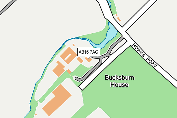
AB16 7AG is located in the Kingswells/Sheddocksley/Summerhill electoral ward, within the council area of Aberdeen City and the Scottish Parliamentary constituency of Aberdeen North. The Community Health Partnership is Aberdeen City Community Health Partnership and the police force is Scotland. This postcode has been in use since April 2009.


GetTheData
Source: OS OpenMap – Local (Ordnance Survey)
Source: OS VectorMap District (Ordnance Survey)
Licence: Open Government Licence (requires attribution)
| Easting | 389098 |
| Northing | 808547 |
| Latitude | 57.167639 |
| Longitude | -2.181906 |
GetTheData
Source: Open Postcode Geo
Licence: Open Government Licence
| Country | Scotland |
| Postcode District | AB16 |
➜ See where AB16 is on a map ➜ Where is Aberdeen? | |
GetTheData
Source: Land Registry Price Paid Data
Licence: Open Government Licence
| Ward | Kingswells/Sheddocksley/Summerhill |
| Constituency | Aberdeen North |
GetTheData
Source: ONS Postcode Database
Licence: Open Government Licence
| Sunny Brae (Newhills Avenue) | Newhills | 544m |
| Howes Road | Northfield | 546m |
| Middlemuir Place (Newhills Avenue) | Newhills | 560m |
| Middlemuir Place (Newhills Avenue) | Newhills | 561m |
| Wagley Place (Newhills Avenue) | Newhills | 569m |
| Dyce Station | 4.3km |
GetTheData
Source: NaPTAN
Licence: Open Government Licence
GetTheData
Source: ONS Postcode Database
Licence: Open Government Licence


➜ Get more ratings from the Food Standards Agency
GetTheData
Source: Food Standards Agency
Licence: FSA terms & conditions
| Last Collection | |||
|---|---|---|---|
| Location | Mon-Fri | Sat | Distance |
| Wagley | 17:00 | 12:30 | 651m |
| Bonnyview Road | 17:30 | 12:30 | 731m |
| Lintmill Terrace | 17:30 | 12:30 | 849m |
GetTheData
Source: Dracos
Licence: Creative Commons Attribution-ShareAlike
The below table lists the International Territorial Level (ITL) codes (formerly Nomenclature of Territorial Units for Statistics (NUTS) codes) and Local Administrative Units (LAU) codes for AB16 7AG:
| ITL 1 Code | Name |
|---|---|
| TLM | Scotland |
| ITL 2 Code | Name |
| TLM5 | North Eastern Scotland |
| ITL 3 Code | Name |
| TLM50 | Aberdeen City and Aberdeenshire |
| LAU 1 Code | Name |
| S30000026 | Aberdeen City |
GetTheData
Source: ONS Postcode Directory
Licence: Open Government Licence
The below table lists the Census Output Area (OA), Lower Layer Super Output Area (LSOA), and Middle Layer Super Output Area (MSOA) for AB16 7AG:
| Code | Name | |
|---|---|---|
| OA | S00090423 | |
| LSOA | S01006732 | Kingswells - 01 |
| MSOA | S02001275 | Kingswells |
GetTheData
Source: ONS Postcode Directory
Licence: Open Government Licence