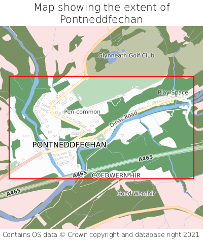
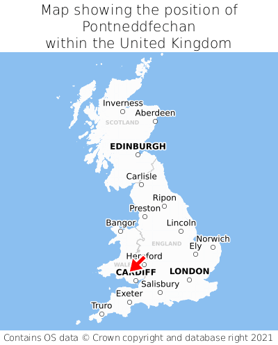
Where is Pontneddfechan?
Pontneddfechan is located in the county of Powys, Wales, one mile north-east of the town of Glyn-neath, 18 miles north-east of the major city of Swansea, 26 miles north-west of Cardiff, and 150 miles west of London. Pontneddfechan lies just north-west of the Mid Glamorgan border, and was historically in the county of Brecknockshire. Pontneddfechan falls within the unitary authority of Powys - Powys. It is in the SA11 postcode district. The post town for Pontneddfechan is Neath.
Pontneddfechan on a map
Which county is Pontneddfechan in?
Pontneddfechan is in the ceremonial county of Powys, the historic county of Brecknockshire, and the administrative county of Powys - Powys.
| Ceremonial County | Powys |
|---|---|
| Historic County | Brecknockshire |
| Administrative County | Powys - Powys |
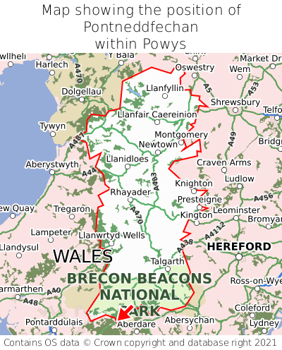
Where is Pontneddfechan in Powys?
Pontneddfechan is situated towards the southernmost extremity of Powys, and roughly centrally between the easternmost and westernmost extremities of Powys.
What is the postcode for Pontneddfechan?
The nearest postcode to the centre of Pontneddfechan is SA11 5NL.
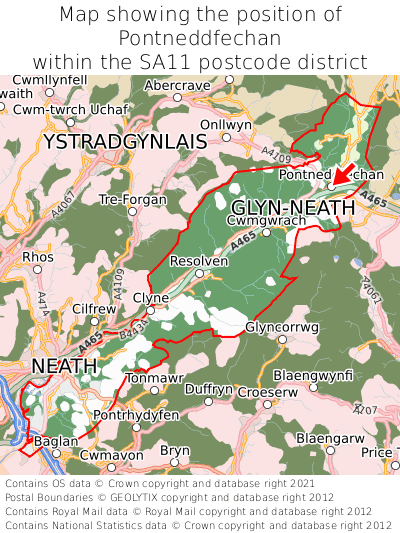
Where is Pontneddfechan in SA11?
Pontneddfechan is situated towards the northernmost extremity of the SA11 postcode district, and towards the easternmost extremity of the SA11 postcode district.
What is the post town for Pontneddfechan?
The post town for Pontneddfechan is Neath. Pontneddfechan is in the SA11 postcode district, which corresponds to the post town of Neath.
What is the latitude and longitude of Pontneddfechan?
The centre of Pontneddfechan is located at position 51.75692° latitude and -3.59124° longitude.
| Latitude | 51.75692° |
|---|---|
| Longitude | -3.59124° |
What is the easting and northing of Pontneddfechan?
The centre of Pontneddfechan is located at the grid reference easting 290267 and northing 207669 within the British National Grid (OSGB36) system.
| Easting | 290267 |
|---|---|
| Northing | 207669 |
What are the nearest towns to Pontneddfechan?
Position of Pontneddfechan relative to nearby towns. Distance is measured from the centre of Pontneddfechan to the centre of the town.
What are the nearest cities to Pontneddfechan?
Position of Pontneddfechan relative to nearby cities. Distance is measured from the centre of Pontneddfechan to the centre of the city.
- Contains OS data © Crown copyright and database right (2024)
- Contains Royal Mail data © Royal Mail copyright and Database right (2024)
- Contains National Statistics data © Crown copyright and database right (2024)
- Data produced by Land Registry © Crown copyright (2024)
- Contains Environment Agency data licensed under the Open Government Licence v3.0
- Everything else © GetTheData Publishing Limited (2024)
GetTheData.com is owned and operated by GetTheData Publishing Limited.
Company Number: 11075184 · Registered in England and Wales.
Registered Office: Advantage, 87 Castle Street, Reading, Berkshire, England, RG1 7SN
By accessing our site you agree to us using cookies, and sharing information about your use of our site, in accordance with our privacy policy.