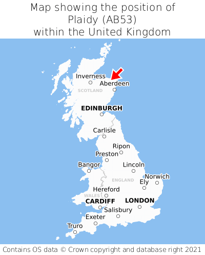
Where is Plaidy?
Plaidy is located in the county of Aberdeenshire, Scotland, three miles north of the town of Turriff, 33 miles north-west of the major city of Aberdeen, 116 miles north of Edinburgh, 423 miles north of Cardiff, and 430 miles north of London. Plaidy lies just north-east of the Banffshire border. Plaidy falls within the unitary authority of Aberdeenshire. It is in the AB53 postcode district. The post town for Plaidy is Turriff.
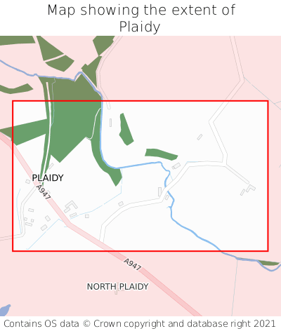
Plaidy on a map
Which county is Plaidy in?
Plaidy is in the ceremonial county of Aberdeenshire, the historic county of Aberdeenshire, and the administrative county of Aberdeenshire.
| Ceremonial County | Aberdeenshire |
|---|---|
| Historic County | Aberdeenshire |
| Administrative County | Aberdeenshire |
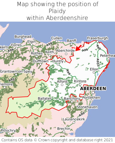
Where is Plaidy in Aberdeenshire?
Plaidy is situated towards the northernmost extremity of Aberdeenshire, and towards the easternmost extremity of Aberdeenshire.
What is the postcode for Plaidy?
The nearest postcode to the centre of Plaidy is AB53 5RJ.
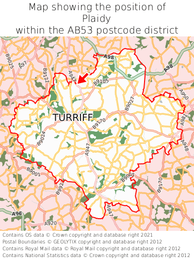
Where is Plaidy in AB53?
Plaidy is situated towards the northernmost extremity of the AB53 postcode district, and roughly centrally between the easternmost and westernmost extremities of the AB53 postcode district.
What is the post town for Plaidy?
The post town for Plaidy is Turriff. Plaidy is in the AB53 postcode district, which corresponds to the post town of Turriff.
What is the latitude and longitude of Plaidy?
The centre of Plaidy is located at position 57.58431° latitude and -2.4539° longitude.
| Latitude | 57.58431° |
|---|---|
| Longitude | -2.4539° |
What is the easting and northing of Plaidy?
The centre of Plaidy is located at the grid reference easting 372959 and northing 855009 within the British National Grid (OSGB36) system.
| Easting | 372959 |
|---|---|
| Northing | 855009 |
What are the nearest towns to Plaidy?
Position of Plaidy relative to nearby towns. Distance is measured from the centre of Plaidy to the centre of the town.
What are the nearest cities to Plaidy?
Position of Plaidy relative to nearby cities. Distance is measured from the centre of Plaidy to the centre of the city.
- Contains OS data © Crown copyright and database right (2025)
- Contains Royal Mail data © Royal Mail copyright and Database right (2025)
- Contains National Statistics data © Crown copyright and database right (2025)
- Data produced by Land Registry © Crown copyright (2025)
- Contains Environment Agency data licensed under the Open Government Licence v3.0
- Everything else © GetTheData Publishing Limited (2025)
GetTheData.com is owned and operated by GetTheData Publishing Limited.
Company Number: 11075184 · Registered in England and Wales.
Registered Office: 3rd Floor, 86-90 Paul Street, London, England, EC2A 4NE
By accessing our site you agree to us using cookies, and sharing information about your use of our site, in accordance with our privacy policy.