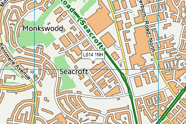
Xercise4less (Leeds North) (Closed) - Seacroft
Xercise4less (Leeds North) (Closed) is located in Seacroft, Leeds (LS14).
| Address | GROUND FLOOR, TEMPLE HOUSE, Ramshead Approach, Seacroft, Leeds, LS14 1NH |
| Car Park | Yes |
| Car Park Capacity | 50 |
| Management Type | Commercial Management |
| Management Group | Commercial |
| Owner Type | Commercial |
| Owner Group | Commercial |
| Education Phase | Select ... |
| Closure Date | 30th Oct 2020 |
| Closure Reason | Financial - insolvency, facilities uneconomic etc |
Facilities
| Closure Date | 30th Oct 2020 |
| Closure Reason | Financial - insolvency, facilities uneconomic etc |
| Accessibility | Registered Membership use |
| Management Type | School/College/University (in house) |
| Year Built | 2016 |
| Changing Rooms | Yes |
| Date Record Created | 7th Mar 2017 |
| Date Record Checked | 19th Jan 2021 |
Opening times
| Access description | Registered Membership use |
|---|
| Opening time | 06:00 |
| Closing time | 22:00 |
| Period open for | Monday-Friday |
| |
| Access description | Registered Membership use |
|---|
| Opening time | 08:00 |
| Closing time | 20:00 |
| Period open for | Weekend |
Facility specifics
Disabled access
| Disabled Access | Yes |
| Finding/Reaching Entrance | Yes |
| Reception Area | Yes |
| Doorways | Yes |
| Emergency Exits | Yes |
Contact
Disabled access
Disabled access for Xercise4less (Leeds North) (Closed)
| Disabled Access | Yes |
| Finding/Reaching Entrance | Yes |
| Reception Area | Yes |
| Doorways | Yes |
| Emergency Exits | Yes |
Where is Xercise4less (Leeds North) (Closed)?
| Sub Building Name | GROUND FLOOR |
| Building Name | TEMPLE HOUSE |
| Building Number | 0 |
| Dependent Thoroughfare | |
| Thoroughfare Name | RAMSHEAD APPROACH |
| Double Dependent Locality | |
| Dependent Locality | SEACROFT |
| PostTown | LEEDS |
| Postcode | LS14 1NH |
Xercise4less (Leeds North) (Closed) on a map

Xercise4less (Leeds North) (Closed) geodata
| Easting | 435625.04 |
| Northing | 436818.58 |
| Latitude | 53.82642 |
| Longitude | -1.460262 |
| Local Authority Name | Leeds |
| Local Authority Code | E08000035 |
| Parliamentary Constituency Name | Leeds East |
| Parliamentary Constituency Code | E14000778 |
| Region Name | Yorkshire and the Humber |
| Region Code | E15000003 |
| Ward Name | Killingbeck & Seacroft |
| Ward Code | E05011400 |
| Output Area Code | E00058779 |
About this data
This data is open data sourced from Active Places Power and licenced under the Active Places Open Data Licence.
| toid | osgb1000032946595 |
| Created On | 7th Mar 2017 |
| Audited On | 21st Aug 2020 |
| Checked On | 19th Jan 2021 |
