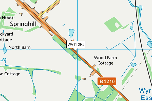
Woodfarm Golf Range (Closed) - Springhill
Woodfarm Golf Range (Closed) is located in Springhill (WV11).
| Address | THE RANGE, WOOD FARM, Broad Lane, Springhill, WV11 2RJ |
| Car Park | Yes |
| Car Park Capacity | 120 |
| Management Type | Commercial Management |
| Management Group | Commercial |
| Owner Type | Commercial |
| Owner Group | Commercial |
| Education Phase | Not Known |
| Closure Date | 6th May 2022 |
| Closure Reason | Redevelopment - loss due to development project (e.g. major schemes such as HS2, new roads, area regeneration or smaller local development) |
Aliases
Woodfarm Golf Range (Closed) is also known as:
Facilities
| Closure Date | 6th May 2022 |
| Closure Reason | Redevelopment - loss due to development project (e.g. major schemes such as HS2, new roads, area regeneration or smaller local development) |
| Accessibility | Pay and Play |
| Management Type | Commercial Management |
| Year Built | 2002 |
| Changing Rooms | No |
| Date Record Checked | 10th Oct 2022 |
Opening times
| Access description | Pay and Play |
|---|
| Opening time | 09:00 |
| Closing time | 21:00 |
| Period open for | Every day |
Facility specifics
Disabled access
| Disabled Access | Yes |
| Disabled Parking | Yes |
| Finding/Reaching Entrance | Yes |
| Reception Area | Yes |
| Doorways | Yes |
| Activity Areas | Yes |
| Disabled Toilets | Yes |
| Social Areas | Yes |
| Spectator Areas | Yes |
| Emergency Exits | Yes |
| Closure Date | 1st Aug 2005 |
| Closure Reason | Unclassified |
| Accessibility | Pay and Play |
| Management Type | Not Known |
| Year Built | 2002 |
| Changing Rooms | Yes |
| Date Record Checked | 10th Aug 2021 |
| Opening Times | Detailed Timings |
Facility specifics
Contact
Disabled access
Disabled access for Woodfarm Golf Range (Closed)
| Disabled Access | Yes |
| Disabled Parking | Yes |
| Finding/Reaching Entrance | Yes |
| Reception Area | Yes |
| Doorways | Yes |
| Activity Areas | Yes |
| Disabled Toilets | Yes |
| Social Areas | Yes |
| Spectator Areas | Yes |
| Emergency Exits | Yes |
Where is Woodfarm Golf Range (Closed)?
| Sub Building Name | THE RANGE |
| Building Name | WOOD FARM |
| Building Number | 0 |
| Dependent Thoroughfare | |
| Thoroughfare Name | BROAD LANE |
| Double Dependent Locality | |
| Dependent Locality | |
| PostTown | SPRINGHILL |
| Postcode | WV11 2RJ |
Woodfarm Golf Range (Closed) on a map

Woodfarm Golf Range (Closed) geodata
| Easting | 398168 |
| Northing | 303770 |
| Latitude | 52.63168 |
| Longitude | -2.028502 |
| Local Authority Name | South Staffordshire |
| Local Authority Code | E07000196 |
| Parliamentary Constituency Name | South Staffordshire |
| Parliamentary Constituency Code | E14000945 |
| Region Name | West Midlands |
| Region Code | E15000005 |
| Ward Name | Essington |
| Ward Code | E05006994 |
| Output Area Code | E00150983 |
About this data
This data is open data sourced from Active Places Power and licenced under the Active Places Open Data Licence.
| toid | osgb1000025036893 |
| Created On | 4th Jun 2004 |
| Audited On | 10th Aug 2021 |
| Checked On | 7th Oct 2022 |
