Wellness On Wheels (Closed) - Crook
Wellness On Wheels (Closed) is located in Crook (DL15).
| Address | Civic Centre, North Terrace, Crook, DL15 9ES |
| Management Type | Local Authority (in house) |
| Management Group | Local Authority |
| Owner Type | Local Authority |
| Owner Group | Local Authority |
| Education Phase | Not Known |
| Start Date | 1st Jun 2005 |
| Closure Date | 15th Mar 2017 |
| Closure Reason | Unclassified |
Facilities
| Closure Date | 15th Mar 2017 |
| Closure Reason | Unclassified |
| Accessibility | Free Public Access |
| Management Type | Local Authority (in house) |
| Year Built | 2005 |
| Changing Rooms | No |
| Date Record Checked | 15th Mar 2017 |
Opening times
| Access description | Free Public Access |
|---|
| Opening time | 10:00 |
| Closing time | 19:00 |
| Period open for | Monday |
| |
| Access description | Free Public Access |
|---|
| Opening time | 10:00 |
| Closing time | 19:00 |
| Period open for | Tuesday |
| |
| Access description | Free Public Access |
|---|
| Opening time | 10:00 |
| Closing time | 19:00 |
| Period open for | Wednesday |
| |
| Access description | Free Public Access |
|---|
| Opening time | 10:00 |
| Closing time | 19:00 |
| Period open for | Thursday |
| |
| Access description | Free Public Access |
|---|
| Opening time | 09:00 |
| Closing time | 18:00 |
| Period open for | Friday |
Facility specifics
Disabled access
| Disabled Access | Yes |
| Finding/Reaching Entrance | Yes |
| Doorways | Yes |
| Activity Areas | Yes |
| Emergency Exits | Yes |
Contact
Disabled access
Disabled access for Wellness On Wheels (Closed)
| Disabled Access | Yes |
| Finding/Reaching Entrance | Yes |
| Doorways | Yes |
| Activity Areas | Yes |
| Emergency Exits | Yes |
| Notes | Lift |
Where is Wellness On Wheels (Closed)?
| Sub Building Name | |
| Building Name | Civic Centre |
| Building Number | 0 |
| Dependent Thoroughfare | |
| Thoroughfare Name | North Terrace |
| Double Dependent Locality | |
| Dependent Locality | |
| PostTown | Crook |
| Postcode | DL15 9ES |
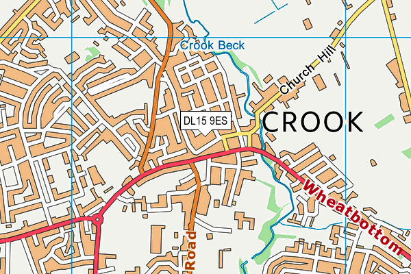
Wellness On Wheels (Closed) on a map

Wellness On Wheels (Closed) geodata
| Easting | 416475 |
| Northing | 535643 |
| Latitude | 54.715526 |
| Longitude | -1.745785 |
| Local Authority Name | County Durham |
| Local Authority Code | E06000047 |
| Parliamentary Constituency Name | North West Durham |
| Parliamentary Constituency Code | E14000856 |
| Region Name | North East |
| Region Code | E15000001 |
| Ward Name | Crook |
| Ward Code | E05009053 |
| Output Area Code | E00105969 |
About this data
This data is open data sourced from Active Places Power and licenced under the Active Places Open Data Licence.
| Created On | 19th Sep 2006 |
| Audited On | 23rd Mar 2015 |
| Checked On | 15th Mar 2017 |
