Waves Health & Leisure Club (Baron's Court) (Closed) - Walsall Wood
Waves Health & Leisure Club (Baron's Court) (Closed) is located in Walsall Wood, Walsall (WS9).
| Address | Walsall Road, Walsall Wood, Walsall, WS9 9AH |
| Car Park | Yes |
| Car Park Capacity | 150 |
| Management Type | Commercial Management |
| Management Group | Commercial |
| Owner Type | Commercial |
| Owner Group | Commercial |
| Education Phase | Not Known |
| Closure Date | 1st Mar 2010 |
| Closure Reason | Unclassified |
Facilities
| Closure Date | 1st Mar 2010 |
| Closure Reason | Unclassified |
| Accessibility | Registered Membership use |
| Management Type | Not Known |
| Year Built | 1990 |
| Year Refurbished | 1998 |
| Changing Rooms | Yes |
| Year Changing Rooms Refurbished | 2008 |
| Date Record Checked | 1st Nov 2010 |
| Opening Times | Detailed Timings |
Facility specifics
| Access to Pool Hoist | No |
| Area | 50m² |
| Diving Boards | No |
| Length | 10m |
| Maximum Depth | 1.7m |
| Minimum Depth | 1.2m |
| Movable Floor | No |
| Width | 5m |
| Closure Date | 1st Mar 2010 |
| Closure Reason | Unclassified |
| Accessibility | Registered Membership use |
| Management Type | Not Known |
| Year Built | 1990 |
| Year Refurbished | 1998 |
| Changing Rooms | Yes |
| Year Changing Rooms Refurbished | 2008 |
| Date Record Checked | 1st Nov 2010 |
| Opening Times | Detailed Timings |
Facility specifics
Contact
Disabled access
Disabled access for Waves Health & Leisure Club (Baron's Court) (Closed)
| Notes | No way of Getting to Gym or Pool |
Where is Waves Health & Leisure Club (Baron's Court) (Closed)?
| Sub Building Name | |
| Building Name | |
| Building Number | 0 |
| Dependent Thoroughfare | |
| Thoroughfare Name | Walsall Road |
| Double Dependent Locality | |
| Dependent Locality | Walsall Wood |
| PostTown | Walsall |
| Postcode | WS9 9AH |
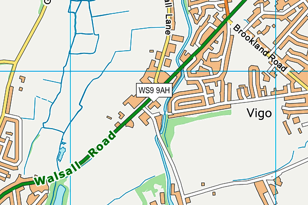
Waves Health & Leisure Club (Baron's Court) (Closed) on a map

Waves Health & Leisure Club (Baron's Court) (Closed) geodata
| Easting | 404358.6 |
| Northing | 302789.6 |
| Latitude | 52.622854 |
| Longitude | -1.937049 |
| Local Authority Name | Walsall |
| Local Authority Code | E08000030 |
| Parliamentary Constituency Name | Aldridge-Brownhills |
| Parliamentary Constituency Code | E14000531 |
| Region Name | West Midlands |
| Region Code | E15000005 |
| Ward Name | Aldridge North and Walsall Wood |
| Ward Code | E05001302 |
| Output Area Code | E00051830 |
About this data
This data is open data sourced from Active Places Power and licenced under the Active Places Open Data Licence.
| Created On | 18th May 2004 |
| Audited On | 26th Jan 2015 |
| Checked On | 1st Nov 2010 |
