Wallscourt Farm Gym - Bristol
Wallscourt Farm Gym is located in Bristol (BS34), and offers Health and Fitness Gym, and Squash Courts.
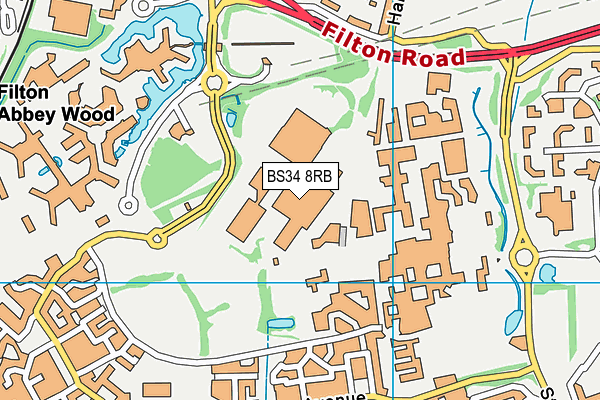
| Address | WALLSCOURT FARM, Filton Road, Bristol, BS34 8RB |
| Management Type | School/College/University (in house) |
| Management Group | Education |
| Owner Type | Higher Education Institutions |
| Owner Group | Education |
| Education Phase | Not applicable |
| Start Date | 1st Jul 2009 |
Facilities
| Accessibility | Registered Membership use |
| Management Type | School/College/University (in house) |
| Year Built | 2009 |
| Year Refurbished | 2015 |
| Changing Rooms | Yes |
| Date Record Checked | 17th Oct 2023 |
Opening times
| Access description | Registered Membership use |
|---|
| Opening time | 07:30 |
| Closing time | 20:00 |
| Period open for | Monday-Friday |
Facility specifics
Disabled access
| Disabled Access | Yes |
| Finding/Reaching Entrance | Yes |
| Reception Area | Yes |
| Doorways | Yes |
| Activity Areas | Yes |
| Social Areas | Yes |
| Emergency Exits | Yes |
| Accessibility | Registered Membership use |
| Management Type | School/College/University (in house) |
| Year Built | 2009 |
| Year Refurbished | 2014 |
| Changing Rooms | Yes |
| Date Record Checked | 17th Oct 2023 |
Opening times
| Access description | Registered Membership use |
|---|
| Opening time | 07:30 |
| Closing time | 20:00 |
| Period open for | Monday-Friday |
Facility specifics
Disabled access
| Disabled Access | Yes |
| Finding/Reaching Entrance | Yes |
| Reception Area | Yes |
| Doorways | Yes |
| Activity Areas | Yes |
| Social Areas | Yes |
| Emergency Exits | Yes |
Contact
Disabled access
Disabled access for Wallscourt Farm Gym
| Disabled Access | Yes |
| Finding/Reaching Entrance | Yes |
| Reception Area | Yes |
| Doorways | Yes |
| Activity Areas | Yes |
| Social Areas | Yes |
| Emergency Exits | Yes |
Where is Wallscourt Farm Gym?
| Sub Building Name | |
| Building Name | WALLSCOURT FARM |
| Building Number | 0 |
| Dependent Thoroughfare | |
| Thoroughfare Name | FILTON ROAD |
| Double Dependent Locality | |
| Dependent Locality | |
| PostTown | BRISTOL |
| Postcode | BS34 8RB |
Wallscourt Farm Gym on a map

Wallscourt Farm Gym geodata
| Easting | 361792 |
| Northing | 177998 |
| Latitude | 51.49962 |
| Longitude | -2.55182 |
| Local Authority Name | South Gloucestershire |
| Local Authority Code | E06000025 |
| Parliamentary Constituency Name | Filton and Bradley Stoke |
| Parliamentary Constituency Code | E14000702 |
| Region Name | South West |
| Region Code | E15000009 |
| Ward Name | Stoke Park & Cheswick |
| Ward Code | E05012126 |
| Output Area Code | E00173089 |
About this data
This data is open data sourced from Active Places Power and licenced under the Active Places Open Data Licence.
| toid | osgb1000015102434 |
| Created On | 2nd Aug 2010 |
| Audited On | 17th Oct 2023 |
| Checked On | 17th Oct 2023 |
