Torfield Multi Use Games Area - Hastings
Torfield Multi Use Games Area is located in Hastings (TN34), and offers Artificial Grass Pitch.
| Address | MULTI USE GAMES AREA, TORFIELD SCHOOL, 88, Croft Road, Hastings, TN34 3JT |
| Management Type | Local Authority (in house) |
| Management Group | Local Authority |
| Owner Type | Local Authority |
| Owner Group | Local Authority |
| Education Phase | Not applicable |
| Start Date | 1st Jan 2005 |
Aliases
Torfield Multi Use Games Area is also known as:
Facilities
| Accessibility | Pay and Play |
| Management Type | Local Authority (in house) |
| Year Built | 2005 |
| Changing Rooms | No |
| Date Record Checked | 4th Jul 2023 |
Opening times
| Access description | Private Use |
|---|
| Opening time | 09:00 |
| Closing time | 17:00 |
| Period open for | Monday-Friday |
| |
| Access description | Pay and Play |
|---|
| Opening time | 17:00 |
| Closing time | 21:00 |
| Period open for | Monday-Friday |
| |
| Access description | Pay and Play |
|---|
| Opening time | 09:00 |
| Closing time | 21:00 |
| Period open for | Weekend |
Facility specifics
| Area | 722m² |
| Floodlit | Yes |
| Indoor | No |
| Length | 38m |
| Width | 19m |
| WR22 Compliant Pitch | No |
Disabled access
| Disabled Access | Yes |
| Finding/Reaching Entrance | Yes |
| Activity Areas | Yes |
Contact
Disabled access
Disabled access for Torfield Multi Use Games Area
| Disabled Access | Yes |
| Disabled Parking | Yes |
| Finding/Reaching Entrance | Yes |
| Reception Area | Yes |
| Doorways | Yes |
| Activity Areas | Yes |
| Social Areas | Yes |
| Spectator Areas | Yes |
| Emergency Exits | Yes |
Where is Torfield Multi Use Games Area?
| Sub Building Name | MULTI USE GAMES AREA |
| Building Name | TORFIELD SCHOOL |
| Building Number | 88 |
| Dependent Thoroughfare | |
| Thoroughfare Name | CROFT ROAD |
| Double Dependent Locality | |
| Dependent Locality | |
| PostTown | HASTINGS |
| Postcode | TN34 3JT |
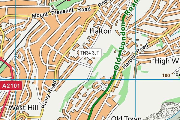
Torfield Multi Use Games Area on a map

Torfield Multi Use Games Area geodata
| Easting | 582626 |
| Northing | 110209 |
| Latitude | 50.862546 |
| Longitude | 0.593711 |
| Local Authority Name | Hastings |
| Local Authority Code | E07000062 |
| Parliamentary Constituency Name | Hastings and Rye |
| Parliamentary Constituency Code | E14000735 |
| Region Name | South East |
| Region Code | E15000008 |
| Ward Name | Tressell |
| Ward Code | E05011214 |
| Output Area Code | E00106720 |
About this data
This data is open data sourced from Active Places Power and licenced under the Active Places Open Data Licence.
| toid | osgb1000002041279932 |
| Created On | 10th Feb 2014 |
| Audited On | 4th Jul 2023 |
| Checked On | 4th Jul 2023 |
