Tolleshunt Major Playing Field
Tolleshunt Major Playing Field is located in Tolleshunt Major (CM9).
| Address | PLAYING FIELD, Tolleshunt D'arcy Road, Tolleshunt Major, CM9 8LN |
| Car Park | Yes |
| Car Park Capacity | 10 |
| Management Type | Local Authority (in house) |
| Management Group | Local Authority |
| Owner Type | Local Authority |
| Owner Group | Local Authority |
| Education Phase | Not applicable |
Facilities
| Accessibility | Free Public Access |
| Management Type | Local Authority (in house) |
| Year Built | 1950 |
| Changing Rooms | No |
| Date Record Checked | 14th Sep 2022 |
| Opening Times | Dawn To Dusk |
Facility specifics
Contact
Where is Tolleshunt Major Playing Field?
| Sub Building Name | |
| Building Name | PLAYING FIELD |
| Building Number | 0 |
| Dependent Thoroughfare | |
| Thoroughfare Name | TOLLESHUNT D'ARCY ROAD |
| Double Dependent Locality | |
| Dependent Locality | |
| PostTown | TOLLESHUNT MAJOR |
| Postcode | CM9 8LN |
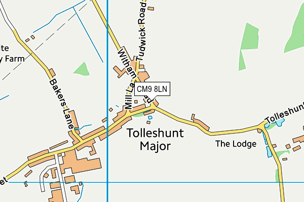
Tolleshunt Major Playing Field on a map

Tolleshunt Major Playing Field geodata
| Easting | 590333 |
| Northing | 211361 |
| Latitude | 51.768563 |
| Longitude | 0.757054 |
| Local Authority Name | Maldon |
| Local Authority Code | E07000074 |
| Parliamentary Constituency Name | Witham |
| Parliamentary Constituency Code | E14001045 |
| Region Name | Eastern |
| Region Code | E15000006 |
| Ward Name | Tolleshunt D'arcy |
| Ward Code | E05004205 |
| Output Area Code | E00111296 |
About this data
This data is open data sourced from Active Places Power and licenced under the Active Places Open Data Licence.
| toid | osgb1000002081108721 |
| Created On | 15th Oct 2006 |
| Audited On | 14th Sep 2022 |
| Checked On | 14th Sep 2022 |
