Thornton Hough - Wirral
Thornton Hough is located in Wirral (CH63), and offers Grass Pitches, and Outdoor Tennis Courts.
| Address | Neston Rd, Wirral, CH63 1JE |
| Management Type | Local Authority (in house) |
| Management Group | Local Authority |
| Owner Type | Local Authority |
| Owner Group | Local Authority |
| Education Phase | Not applicable |
Facilities
| Accessibility | Pay and Play |
| Management Type | Local Authority (in house) |
| Changing Rooms | Yes |
| Date Record Checked | 23rd Feb 2023 |
Opening times
| Access description | Pay and Play |
|---|
| Opening time | 09:00 |
| Closing time | 17:00 |
| Period open for | Monday-Friday |
| |
| Access description | Sports Club / Community Association |
|---|
| Opening time | 09:00 |
| Closing time | 17:00 |
| Period open for | Weekend |
Facility specifics
Disabled access
| Disabled Access | Yes |
| Activity Areas | Yes |
| Accessibility | Pay and Play |
| Management Type | Local Authority (in house) |
| Year Built | 1990 |
| Year Refurbished | 2011 |
| Changing Rooms | Yes |
| Date Record Checked | 23rd Feb 2023 |
Opening times
| Access description | Sports Club / Community Association |
|---|
| Opening time | 09:00 |
| Closing time | 17:00 |
| Period open for | Weekend |
| |
| Access description | Pay and Play |
|---|
| Opening time | 09:00 |
| Closing time | 17:00 |
| Period open for | Monday-Friday |
Facility specifics
| Floodlit | No |
| Overmarked | No |
| Surface Type | Other |
Disabled access
| Disabled Access | Yes |
| Activity Areas | Yes |
| Status Notes | 1 AGW
|
| Accessibility | Pay and Play |
| Management Type | Local Authority (in house) |
| Changing Rooms | Yes |
| Date Record Checked | 23rd Feb 2023 |
Opening times
| Access description | Pay and Play |
|---|
| Opening time | 09:00 |
| Closing time | 17:00 |
| Period open for | Monday-Friday |
| |
| Access description | Sports Club / Community Association |
|---|
| Opening time | 09:00 |
| Closing time | 17:00 |
| Period open for | Weekend |
Facility specifics
Disabled access
| Disabled Access | Yes |
| Activity Areas | Yes |
Contact
Disabled access
Disabled access for Thornton Hough
| Disabled Access | Yes |
| Activity Areas | Yes |
Where is Thornton Hough?
| Sub Building Name | |
| Building Name | |
| Building Number | 0 |
| Dependent Thoroughfare | |
| Thoroughfare Name | NESTON RD |
| Double Dependent Locality | |
| Dependent Locality | |
| PostTown | WIRRAL |
| Postcode | CH63 1JE |
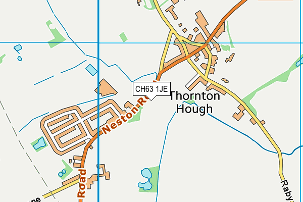
Thornton Hough on a map

Thornton Hough geodata
| Easting | 330426.76 |
| Northing | 380845.31 |
| Latitude | 53.319943 |
| Longitude | -3.045883 |
| Local Authority Name | Wirral |
| Local Authority Code | E08000015 |
| Parliamentary Constituency Name | Wirral South |
| Parliamentary Constituency Code | E14001043 |
| Region Name | North West |
| Region Code | E15000002 |
| Ward Name | Clatterbridge |
| Ward Code | E05000958 |
| Output Area Code | E00036194 |
About this data
This data is open data sourced from Active Places Power and licenced under the Active Places Open Data Licence.
| Created On | 16th Nov 2006 |
| Audited On | 23rd Feb 2023 |
| Checked On | 23rd Feb 2023 |
