The William Holding Field - Kingsclere
The William Holding Field is located in Kingsclere, Newbury (RG20), and offers Outdoor Tennis Courts, and Grass Pitches.
| Address | Ashford Hill Road, Kingsclere, Newbury, RG20 5NU |
| Car Park | Yes |
| Car Park Capacity | 30 |
| Management Type | Local Authority (in house) |
| Management Group | Local Authority |
| Owner Type | Local Authority |
| Owner Group | Local Authority |
| Education Phase | Not applicable |
Facilities
| Closure Date | 5th Nov 2018 |
| Closure Reason | Strategic Review - facility/site to be replaced at another site |
| Accessibility | Sports Club / Community Association |
| Management Type | Local Authority (in house) |
| Year Built | 1900 |
| Changing Rooms | No |
| Date Record Checked | 26th Aug 2022 |
| Opening Times | Dawn To Dusk |
Facility specifics
Disabled access
| Disabled Access | Yes |
| Activity Areas | Yes |
| Accessibility | Sports Club / Community Association |
| Management Type | Local Authority (in house) |
| Year Built | 1920 |
| Year Refurbished | 2008 |
| Changing Rooms | Yes |
| Date Record Checked | 26th Aug 2022 |
| Opening Times | Dawn To Dusk |
Facility specifics
| Floodlit | No |
| Overmarked | No |
| Surface Type | Macadam |
Disabled access
| Disabled Access | Yes |
| Activity Areas | Yes |
| Status Notes | All weather wicket removed October 2019 but field still suitable for cricket in dry weather.
|
| Accessibility | Sports Club / Community Association |
| Management Type | Local Authority (in house) |
| Year Built | 2005 |
| Changing Rooms | No |
| Date Record Checked | 26th Aug 2022 |
| Opening Times | Dawn To Dusk |
Facility specifics
Disabled access
| Disabled Access | Yes |
| Activity Areas | Yes |
Contact
Disabled access
Disabled access for The William Holding Field
| Disabled Access | Yes |
| Activity Areas | Yes |
Where is The William Holding Field?
| Sub Building Name | |
| Building Name | |
| Building Number | 0 |
| Dependent Thoroughfare | |
| Thoroughfare Name | Ashford Hill Road |
| Double Dependent Locality | |
| Dependent Locality | Kingsclere |
| PostTown | Newbury |
| Postcode | RG20 5NU |
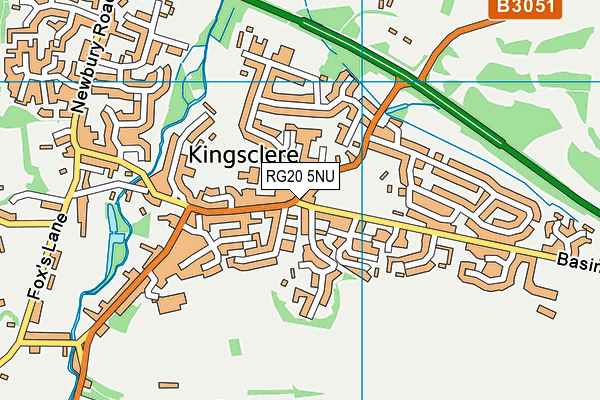
The William Holding Field on a map

The William Holding Field geodata
| Easting | 452915 |
| Northing | 158744 |
| Latitude | 51.325344 |
| Longitude | -1.241978 |
| Local Authority Name | Basingstoke and Deane |
| Local Authority Code | E07000084 |
| Parliamentary Constituency Name | North West Hampshire |
| Parliamentary Constituency Code | E14000857 |
| Region Name | South East |
| Region Code | E15000008 |
| Ward Name | Tadley North, Kingsclere & Baughurst |
| Ward Code | E05013093 |
| Output Area Code | E00114507 |
About this data
This data is open data sourced from Active Places Power and licenced under the Active Places Open Data Licence.
| Created On | 10th Jul 2009 |
| Audited On | 26th Aug 2022 |
| Checked On | 31st Aug 2022 |
