The Croft (Closed) - Weeton
The Croft (Closed) is located in Weeton, Preston (PR4).
| Address | Knowsley Crescent, Weeton, Preston, PR4 3ND |
| Car Park | Yes |
| Management Type | Community Organisation |
| Management Group | Others |
| Owner Type | Community Organisation |
| Owner Group | Community Organisation |
| Education Phase | Not Known |
| Closure Date | 1st Jan 2007 |
| Closure Reason | Unclassified |
Facilities
| Closure Date | 1st Jan 2007 |
| Closure Reason | Unclassified |
| Accessibility | Free Public Access |
| Management Type | Not Known |
| Changing Rooms | No |
| Date Record Checked | 29th Nov 2012 |
| Opening Times | Detailed Timings |
Facility specifics
Contact
Where is The Croft (Closed)?
| Sub Building Name | |
| Building Name | |
| Building Number | 0 |
| Dependent Thoroughfare | |
| Thoroughfare Name | Knowsley Crescent |
| Double Dependent Locality | |
| Dependent Locality | Weeton |
| PostTown | Preston |
| Postcode | PR4 3ND |
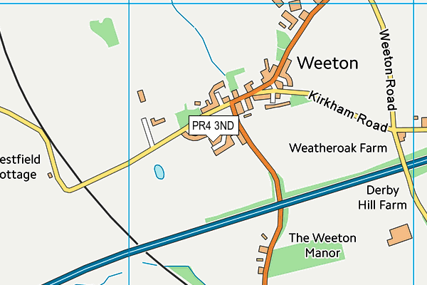
The Croft (Closed) on a map

The Croft (Closed) geodata
| Easting | 338359 |
| Northing | 434583 |
| Latitude | 53.803874 |
| Longitude | -2.937445 |
| Local Authority Name | Fylde |
| Local Authority Code | E07000119 |
| Parliamentary Constituency Name | Fylde |
| Parliamentary Constituency Code | E14000706 |
| Region Name | North West |
| Region Code | E15000002 |
| Ward Name | Staining and Weeton |
| Ward Code | E05005204 |
| Output Area Code | E00127032 |
About this data
This data is open data sourced from Active Places Power and licenced under the Active Places Open Data Licence.
| Created On | 23rd Oct 2009 |
| Audited On | 26th Jan 2015 |
| Checked On | 29th Nov 2012 |
