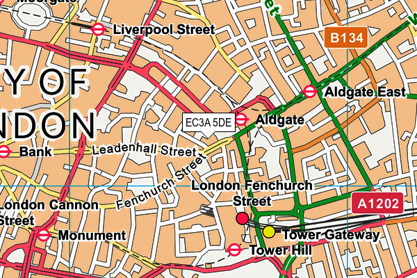
The Aldgate School - London
The Aldgate School is located in London (EC3A), and offers Sports Hall.
| Address | St. James's Passage, London, EC3A 5DE |
| Management Type | School/College/University (in house) |
| Management Group | Education |
| Owner Type | Voluntary Aided School |
| Owner Group | Education |
| Education Phase | Primary |
Aliases
The Aldgate School is also known as:
- Sir John Cass's Foundation Primary School
Facilities
| Accessibility | Private Use |
| Management Type | School/College/University (in house) |
| Year Built | 1909 |
| Changing Rooms | No |
| Date Record Checked | 28th Apr 2023 |
Opening times
| Access description | Private Use |
|---|
| Opening time | 07:45 |
| Closing time | 18:00 |
| Period open for | Monday-Friday |
Facility specifics
| Area | 180m² |
| Floor Matting | Don't Know |
| Gymnastics Trampoline Use | Don't Know |
| Length | 18m |
| Moveable Balance Apparatus | Don't Know |
| Moveable Large Apparatus | Don't Know |
| Moveable Rebound Apparatus | Don't Know |
| Moveable Trampolines | Don't Know |
| Width | 10m |
| Small Apparatus | Don't Know |
| Swinging and Hanging Apparatus | Don't Know |
Disabled access
| Disabled Access | Yes |
| Reception Area | Yes |
| Doorways | Yes |
| Disabled Toilets | Yes |
| Emergency Exits | Yes |
| Notes | Two flights of stairs. Limited access across the school. |
Contact
Disabled access
Disabled access for The Aldgate School
| Disabled Access | Yes |
| Reception Area | Yes |
| Doorways | Yes |
| Disabled Toilets | Yes |
| Emergency Exits | Yes |
| Notes | Two flights of stairs. Limited access across the school. |
Where is The Aldgate School?
| Sub Building Name | |
| Building Name | |
| Building Number | 0 |
| Dependent Thoroughfare | |
| Thoroughfare Name | ST. JAMES'S PASSAGE |
| Double Dependent Locality | |
| Dependent Locality | |
| PostTown | LONDON |
| Postcode | EC3A 5DE |
The Aldgate School on a map

The Aldgate School geodata
| Easting | 533502 |
| Northing | 181167 |
| Latitude | 51.513662 |
| Longitude | -0.077486 |
| Local Authority Name | City of London |
| Local Authority Code | E09000001 |
| Parliamentary Constituency Name | Cities of London and Westminster |
| Parliamentary Constituency Code | E14000639 |
| Region Name | London |
| Region Code | E15000007 |
| Ward Name | Tower |
| Ward Code | E05009310 |
| Output Area Code | E00000035 |
About this data
This data is open data sourced from Active Places Power and licenced under the Active Places Open Data Licence.
| toid | osgb1000006036144 |
| Created On | 22nd Nov 2011 |
| Audited On | 28th Apr 2023 |
| Checked On | 28th Apr 2023 |
