Taunton Cssc Sports & Leisure (Closed)
Taunton Cssc Sports & Leisure (Closed) is located in Taunton (TA1).
| Address | Trull Road, Taunton, TA1 4QP |
| Management Type | CSSC |
| Management Group | Others |
| Owner Type | Commercial |
| Owner Group | Commercial |
| Education Phase | Not Known |
| Closure Date | 19th Sep 2009 |
| Closure Reason | Unclassified |
Facilities
| Closure Date | 19th Sep 2009 |
| Closure Reason | Unclassified |
| Accessibility | Not Known |
| Management Type | Not Known |
| Date Record Checked | 9th Feb 2010 |
| Opening Times | Detailed Timings |
Facility specifics
| Closure Date | 19th Sep 2009 |
| Closure Reason | Unclassified |
| Accessibility | Not Known |
| Management Type | Not Known |
| Date Record Checked | 9th Feb 2010 |
| Opening Times | Detailed Timings |
Facility specifics
| Access to Pool Hoist | No |
| Area | 0m² |
| Diving Boards | No |
| Length | 0m |
| Maximum Depth | 0m |
| Minimum Depth | 0m |
| Movable Floor | No |
| Width | 0m |
| Closure Date | 19th Sep 2009 |
| Closure Reason | Unclassified |
| Accessibility | Sports Club / Community Association |
| Management Type | Not Known |
| Year Built | 1955 |
| Changing Rooms | Yes |
| Year Changing Rooms Refurbished | 1994 |
| Date Record Checked | 9th Feb 2010 |
| Opening Times | Detailed Timings |
Facility specifics
Contact
Where is Taunton Cssc Sports & Leisure (Closed)?
| Sub Building Name | |
| Building Name | |
| Building Number | 0 |
| Dependent Thoroughfare | |
| Thoroughfare Name | Trull Road |
| Double Dependent Locality | |
| Dependent Locality | |
| PostTown | Taunton |
| Postcode | TA1 4QP |
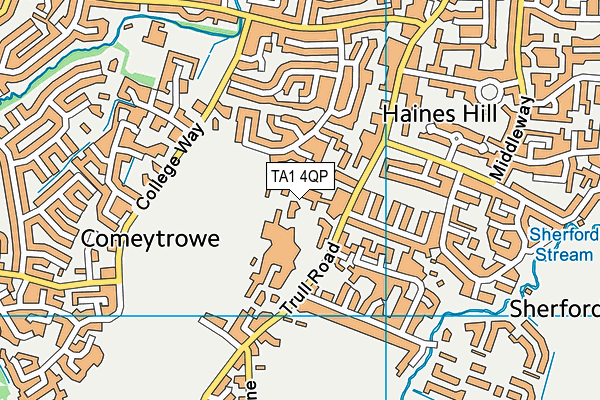
Taunton Cssc Sports & Leisure (Closed) on a map

Taunton Cssc Sports & Leisure (Closed) geodata
| Easting | 321719.33 |
| Northing | 123380.28 |
| Latitude | 51.004463 |
| Longitude | -3.117056 |
| Local Authority Name | Somerset West and Taunton |
| Local Authority Code | E07000246 |
| Parliamentary Constituency Name | Taunton Deane |
| Parliamentary Constituency Code | E14000988 |
| Region Name | South West |
| Region Code | E15000009 |
| Ward Name | Comeytrowe & Bishop's Hull |
| Ward Code | E05012808 |
| Output Area Code | E00149092 |
About this data
This data is open data sourced from Active Places Power and licenced under the Active Places Open Data Licence.
| Created On | 13th Feb 2009 |
| Audited On | 26th Jan 2015 |
| Checked On | 9th Feb 2010 |
