Surbiton High School (Oaken Lane Sports Ground) - Claygate
Surbiton High School (Oaken Lane Sports Ground) is located in Claygate, Esher (KT10), and offers Artificial Grass Pitch.
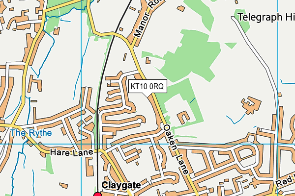
| Address | Oaken Lane, Claygate, Esher, KT10 0RQ |
| Car Park | Yes |
| Car Park Capacity | 30 |
| Management Type | School/College/University (in house) |
| Management Group | Education |
| Owner Type | Other Independent School |
| Owner Group | Education |
| Education Phase | Secondary |
Facilities
| Accessibility | Sports Club / Community Association |
| Management Type | School/College/University (in house) |
| Year Built | 2012 |
| Changing Rooms | Yes |
| Date Record Created | 2nd Apr 2019 |
| Date Record Checked | 16th May 2023 |
Opening times
| Access description | Private Use |
|---|
| Opening time | 08:00 |
| Closing time | 18:30 |
| Period open for | Monday-Friday |
| |
| Access description | Sports Club / Community Association |
|---|
| Opening time | 18:30 |
| Closing time | 19:00 |
| Period open for | Monday-Friday |
| |
| Access description | Sports Club / Community Association |
|---|
| Opening time | 08:00 |
| Closing time | 19:00 |
| Period open for | Weekend |
Facility specifics
| Area | 6200m² |
| Floodlit | Yes |
| Indoor | No |
| Length | 100m |
| Width | 62m |
| WR22 Compliant Pitch | No |
Disabled access
| Disabled Access | Yes |
| Disabled Parking | Yes |
| Activity Areas | Yes |
Contact
Disabled access
Disabled access for Surbiton High School (Oaken Lane Sports Ground)
| Disabled Access | Yes |
| Disabled Parking | Yes |
| Activity Areas | Yes |
Where is Surbiton High School (Oaken Lane Sports Ground)?
| Sub Building Name | |
| Building Name | |
| Building Number | 0 |
| Dependent Thoroughfare | |
| Thoroughfare Name | OAKEN LANE |
| Double Dependent Locality | |
| Dependent Locality | CLAYGATE |
| PostTown | ESHER |
| Postcode | KT10 0RQ |
Surbiton High School (Oaken Lane Sports Ground) on a map

Surbiton High School (Oaken Lane Sports Ground) geodata
| Easting | 515255.3 |
| Northing | 164424.85 |
| Latitude | 51.367201 |
| Longitude | -0.345758 |
| Local Authority Name | Elmbridge |
| Local Authority Code | E07000207 |
| Parliamentary Constituency Name | Esher and Walton |
| Parliamentary Constituency Code | E14000697 |
| Region Name | South East |
| Region Code | E15000008 |
| Ward Name | Claygate |
| Ward Code | E05011074 |
| Output Area Code | E00154549 |
About this data
This data is open data sourced from Active Places Power and licenced under the Active Places Open Data Licence.
| toid | osgb1000001790620800 |
| Created On | 2nd Apr 2019 |
| Audited On | 16th May 2023 |
| Checked On | 16th May 2023 |
