Styrrup Playing Field
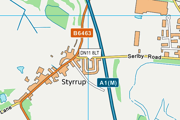
Styrrup Playing Field is located in Styrrup (DN11).
| Address | VILLAGE HALL, Serlby Road, Styrrup, DN11 8LT |
| Car Park | Yes |
| Car Park Capacity | 15 |
| Management Type | Local Authority (in house) |
| Management Group | Local Authority |
| Owner Type | Local Authority |
| Owner Group | Local Authority |
| Education Phase | Not applicable |
Facilities
| Status Notes | Registered field in trust. No longer a full size football pitch hence why we have it listed as a junior size pitch. It is used as a training pitch only and the facility is not let it out to others. |
| Accessibility | Private Use |
| Management Type | Local Authority (in house) |
| Year Refurbished | 1981 |
| Changing Rooms | No |
| Date Record Checked | 3rd May 2023 |
| Opening Times | Dawn To Dusk |
Facility specifics
Disabled access
| Disabled Access | Yes |
| Finding/Reaching Entrance | Yes |
| Doorways | Yes |
| Activity Areas | Yes |
| Disabled Toilets | Yes |
| Emergency Exits | Yes |
Contact
Disabled access
Disabled access for Styrrup Playing Field
| Disabled Access | Yes |
| Finding/Reaching Entrance | Yes |
| Doorways | Yes |
| Activity Areas | Yes |
| Disabled Toilets | Yes |
| Emergency Exits | Yes |
Where is Styrrup Playing Field?
| Sub Building Name | |
| Building Name | VILLAGE HALL |
| Building Number | 0 |
| Dependent Thoroughfare | |
| Thoroughfare Name | SERLBY ROAD |
| Double Dependent Locality | |
| Dependent Locality | |
| PostTown | STYRRUP |
| Postcode | DN11 8LT |
Styrrup Playing Field on a map

Styrrup Playing Field geodata
| Easting | 460936 |
| Northing | 390672 |
| Latitude | 53.409352 |
| Longitude | -1.084791 |
| Local Authority Name | Bassetlaw |
| Local Authority Code | E07000171 |
| Parliamentary Constituency Name | Bassetlaw |
| Parliamentary Constituency Code | E14000546 |
| Region Name | East Midlands |
| Region Code | E15000004 |
| Ward Name | Blyth |
| Ward Code | E05006378 |
| Output Area Code | E00142665 |
About this data
This data is open data sourced from Active Places Power and licenced under the Active Places Open Data Licence.
| toid | osgb1000000112711212 |
| Created On | 26th Mar 2009 |
| Audited On | 3rd May 2023 |
| Checked On | 3rd May 2023 |
