Stower Provost Community School - Stour Provost
Stower Provost Community School is located in Stour Provost, Gillingham (SP8), and offers Grass Pitches, Swimming Pool, and Outdoor Tennis Courts.
| Address | Woodville, Stour Provost, Gillingham, SP8 5LX |
| Car Park | Yes |
| Car Park Capacity | 35 |
| Management Type | School/College/University (in house) |
| Management Group | Education |
| Owner Type | Community school |
| Owner Group | Education |
| Education Phase | Primary |
Facilities
| Accessibility | Private Use |
| Management Type | School/College/University (in house) |
| Year Built | 1850 |
| Changing Rooms | No |
| Date Record Checked | 4th Apr 2023 |
Opening times
| Access description | Private Use |
|---|
| Opening time | 09:00 |
| Closing time | 16:30 |
| Period open for | Monday-Friday |
Facility specifics
Disabled access
| Disabled Access | Yes |
| Disabled Parking | Yes |
| Finding/Reaching Entrance | Yes |
| Reception Area | Yes |
| Doorways | Yes |
| Activity Areas | Yes |
| Disabled Toilets | Yes |
| Social Areas | Yes |
| Spectator Areas | Yes |
| Emergency Exits | Yes |
| Status Notes | Closed in the winter months, open in the summer. |
| Accessibility | Private Use |
| Management Type | School/College/University (in house) |
| Year Built | 1966 |
| Changing Rooms | Yes |
| Date Record Checked | 4th Apr 2023 |
Opening times
| Access description | Private Use |
|---|
| Opening time | 09:00 |
| Closing time | 16:30 |
| Period open for | Monday-Friday |
Facility specifics
| Access to Pool Hoist | No |
| Area | 69m² |
| Diving Boards | No |
| Length | 12.5m |
| Maximum Depth | 1m |
| Minimum Depth | 1m |
| Movable Floor | No |
| Width | 5.5m |
Disabled access
| Disabled Access | Yes |
| Disabled Parking | Yes |
| Finding/Reaching Entrance | Yes |
| Reception Area | Yes |
| Doorways | Yes |
| Activity Areas | Yes |
| Disabled Toilets | Yes |
| Social Areas | Yes |
| Spectator Areas | Yes |
| Emergency Exits | Yes |
| Accessibility | Private Use |
| Management Type | School/College/University (in house) |
| Changing Rooms | Yes |
| Date Record Created | 21st Oct 2019 |
| Date Record Checked | 4th Apr 2023 |
| Opening Times | Dawn To Dusk |
Facility specifics
Disabled access
| Disabled Access | Yes |
| Disabled Parking | Yes |
| Finding/Reaching Entrance | Yes |
| Reception Area | Yes |
| Doorways | Yes |
| Activity Areas | Yes |
| Disabled Toilets | Yes |
| Social Areas | Yes |
| Spectator Areas | Yes |
| Emergency Exits | Yes |
| Notes | partially equipped. some areas of school inaccessible. |
| Status Notes | MUGA - Over- marked with netball courts |
| Accessibility | Private Use |
| Management Type | School/College/University (in house) |
| Year Built | 2001 |
| Year Refurbished | 2017 |
| Changing Rooms | Yes |
| Date Record Created | 21st Oct 2019 |
| Date Record Checked | 4th Apr 2023 |
| Opening Times | Dawn To Dusk |
Facility specifics
| Floodlit | No |
| Overmarked | Yes |
| Surface Type | Concrete |
Disabled access
| Disabled Access | Yes |
| Disabled Parking | Yes |
| Finding/Reaching Entrance | Yes |
| Reception Area | Yes |
| Doorways | Yes |
| Activity Areas | Yes |
| Disabled Toilets | Yes |
| Social Areas | Yes |
| Spectator Areas | Yes |
| Emergency Exits | Yes |
| Notes | partially equipped. some areas of school inaccessible. |
Contact
Disabled access
Disabled access for Stower Provost Community School
| Disabled Access | Yes |
| Disabled Parking | Yes |
| Finding/Reaching Entrance | Yes |
| Reception Area | Yes |
| Doorways | Yes |
| Activity Areas | Yes |
| Disabled Toilets | Yes |
| Social Areas | Yes |
| Spectator Areas | Yes |
| Emergency Exits | Yes |
| Notes | partially equipped. some areas of school inaccessible. |
Where is Stower Provost Community School?
| Sub Building Name | |
| Building Name | |
| Building Number | 0 |
| Dependent Thoroughfare | |
| Thoroughfare Name | Woodville |
| Double Dependent Locality | |
| Dependent Locality | Stour Provost |
| PostTown | Gillingham |
| Postcode | SP8 5LX |
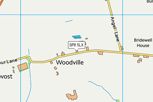
Stower Provost Community School on a map

Stower Provost Community School geodata
| Easting | 380765.39 |
| Northing | 121589.62 |
| Latitude | 50.993378 |
| Longitude | -2.275443 |
| Local Authority Name | Dorset |
| Local Authority Code | E06000059 |
| Parliamentary Constituency Name | North Dorset |
| Parliamentary Constituency Code | E14000839 |
| Region Name | South West |
| Region Code | E15000009 |
| Ward Name | Beacon |
| Ward Code | E05012682 |
| Output Area Code | E00103727 |
About this data
This data is open data sourced from Active Places Power and licenced under the Active Places Open Data Licence.
| Created On | 14th Oct 2006 |
| Audited On | 4th Apr 2023 |
| Checked On | 4th Apr 2023 |
