Staveley Miners Welfare Club
Staveley Miners Welfare Club is located in Staveley, Chesterfield (S43), and offers Sports Hall.
| Address | Market Street, Staveley, Chesterfield, S43 3UT |
| Management Type | Community Organisation |
| Management Group | Others |
| Owner Type | Community Organisation |
| Owner Group | Community Organisation |
| Education Phase | Not applicable |
Facilities
| Status Notes | Used by registered members for dances. |
| Accessibility | Registered Membership use |
| Management Type | Community Organisation |
| Year Built | 1893 |
| Changing Rooms | No |
| Date Record Checked | 30th Jun 2023 |
Opening times
| Access description | Registered Membership use |
|---|
| Opening time | 09:00 |
| Closing time | 22:00 |
| Period open for | Every day |
Facility specifics
| Area | 180m² |
| Floor Matting | Don't Know |
| Gymnastics Trampoline Use | Don't Know |
| Length | 18m |
| Moveable Balance Apparatus | Don't Know |
| Moveable Large Apparatus | Don't Know |
| Moveable Rebound Apparatus | Don't Know |
| Moveable Trampolines | Don't Know |
| Width | 10m |
| Small Apparatus | Don't Know |
| Swinging and Hanging Apparatus | Don't Know |
Disabled access
| Disabled Access | Yes |
| Finding/Reaching Entrance | Yes |
| Reception Area | Yes |
| Doorways | Yes |
| Activity Areas | Yes |
| Disabled Toilets | Yes |
| Social Areas | Yes |
| Emergency Exits | Yes |
Contact
Disabled access
Disabled access for Staveley Miners Welfare Club
| Disabled Access | Yes |
| Finding/Reaching Entrance | Yes |
| Reception Area | Yes |
| Doorways | Yes |
| Activity Areas | Yes |
| Disabled Toilets | Yes |
| Social Areas | Yes |
| Emergency Exits | Yes |
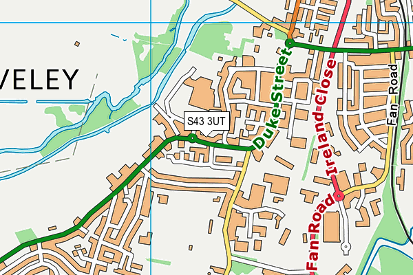
Where is Staveley Miners Welfare Club ?
| Sub Building Name | |
| Building Name | |
| Building Number | 0 |
| Dependent Thoroughfare | |
| Thoroughfare Name | MARKET STREET |
| Double Dependent Locality | |
| Dependent Locality | STAVELEY |
| PostTown | CHESTERFIELD |
| Postcode | S43 3UT |
Staveley Miners Welfare Club on a map

Staveley Miners Welfare Club geodata
| Easting | 443205 |
| Northing | 374580 |
| Latitude | 53.266462 |
| Longitude | -1.353689 |
| Local Authority Name | Chesterfield |
| Local Authority Code | E07000034 |
| Parliamentary Constituency Name | Chesterfield |
| Parliamentary Constituency Code | E14000632 |
| Region Name | East Midlands |
| Region Code | E15000004 |
| Ward Name | Middlecroft and Poolsbrook |
| Ward Code | E05003334 |
| Output Area Code | E00098954 |
About this data
This data is open data sourced from Active Places Power and licenced under the Active Places Open Data Licence.
| toid | osgb1000022183566 |
| Created On | 10th Feb 2014 |
| Audited On | 30th Jun 2023 |
| Checked On | 30th Jun 2023 |
