St Josephs Catholic Primary School (Hampstead) - London
St Josephs Catholic Primary School (Hampstead) is located in London (W9), and offers Artificial Grass Pitch.
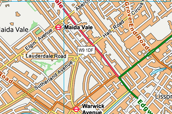
| Address | Lanark Road, London, W9 1DF |
| Management Type | School/College/University (in house) |
| Management Group | Education |
| Owner Type | Community school |
| Owner Group | Education |
| Education Phase | Primary |
Facilities
| Accessibility | Private Use |
| Management Type | School/College/University (in house) |
| Year Built | 2008 |
| Changing Rooms | Yes |
| Date Record Created | 28th Feb 2017 |
| Date Record Checked | 6th Sep 2023 |
Opening times
| Access description | Private Use |
|---|
| Opening time | 08:30 |
| Closing time | 16:00 |
| Period open for | Every day |
Facility specifics
| Area | 510m² |
| Fill | Yes - Rubber |
| Floodlit | No |
| Indoor | No |
| Length | 30m |
| Pile Length | 30mm |
| Width | 17m |
| WR22 Compliant Pitch | No |
Disabled access
| Disabled Access | Yes |
| Finding/Reaching Entrance | Yes |
| Emergency Exits | Yes |
Contact
Disabled access
Disabled access for St Josephs Catholic Primary School (Hampstead)
| Disabled Access | Yes |
| Finding/Reaching Entrance | Yes |
| Emergency Exits | Yes |
Where is St Josephs Catholic Primary School (Hampstead)?
| Sub Building Name | |
| Building Name | |
| Building Number | 0 |
| Dependent Thoroughfare | |
| Thoroughfare Name | LANARK ROAD |
| Double Dependent Locality | |
| Dependent Locality | |
| PostTown | LONDON |
| Postcode | W9 1DF |
St Josephs Catholic Primary School (Hampstead) on a map

St Josephs Catholic Primary School (Hampstead) geodata
| Easting | 526196 |
| Northing | 182511 |
| Latitude | 51.527418 |
| Longitude | -0.182234 |
| Local Authority Name | Westminster |
| Local Authority Code | E09000033 |
| Parliamentary Constituency Name | Westminster North |
| Parliamentary Constituency Code | E14001036 |
| Region Name | London |
| Region Code | E15000007 |
| Ward Name | Little Venice |
| Ward Code | E05013799 |
| Output Area Code | E00023765 |
About this data
This data is open data sourced from Active Places Power and licenced under the Active Places Open Data Licence.
| toid | osgb1000004331187 |
| Created On | 28th Feb 2017 |
| Audited On | 6th Sep 2023 |
| Checked On | 6th Sep 2023 |
