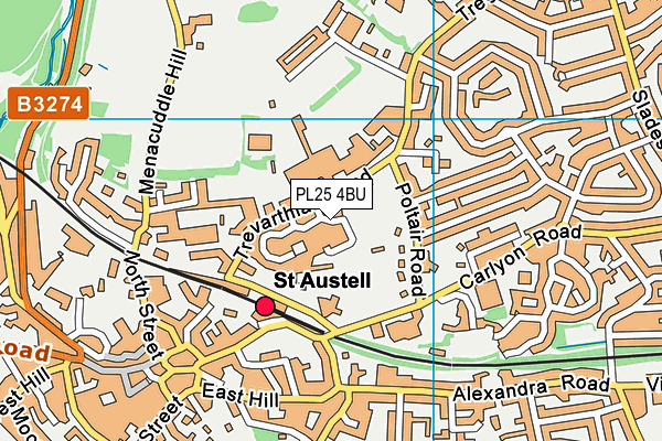
St Austell College (Closed) is located in St. Austell (PL25).
| Address | Trevarthian Road, St. Austell, PL25 4BU |
| Car Park | Yes |
| Car Park Capacity | 600 |
| Management Type | Not Known |
| Management Group | Not Known |
| Owner Type | Further Education |
| Owner Group | Education |
| Education Phase | 16 plus |
| Closure Date | 1st Aug 2006 |
| Closure Reason | Unclassified |
| Closure Date | 1st Aug 2006 |
| Closure Reason | Unclassified |
| Accessibility | Pay and Play |
| Management Type | Not Known |
| Year Built | 1996 |
| Changing Rooms | Yes |
| Date Record Checked | 5th Dec 2006 |
| Opening Times | Detailed Timings |
| Sub Building Name | |
| Building Name | |
| Building Number | 0 |
| Dependent Thoroughfare | |
| Thoroughfare Name | Trevarthian Road |
| Double Dependent Locality | |
| Dependent Locality | |
| PostTown | St. Austell |
| Postcode | PL25 4BU |

GetTheData
Source: OS VectorMap District (Ordnance Survey)
Licence: Open Government Licence (requires attribution)
| Easting | 201776 |
| Northing | 52755 |
| Latitude | 50.341278 |
| Longitude | -4.787143 |
| Local Authority Name | Cornwall |
| Local Authority Code | E06000052 |
| Parliamentary Constituency Name | St Austell and Newquay |
| Parliamentary Constituency Code | E14000961 |
| Region Name | South West |
| Region Code | E15000009 |
| Ward Name | St Austell Poltair |
| Ward Code | E05009246 |
| Output Area Code | E00096242 |
This data is open data sourced from Active Places Power and licenced under the Active Places Open Data Licence.
| Created On | 14th Dec 2014 |
| Audited On | 26th Jan 2015 |
| Checked On | 5th Dec 2006 |
GetTheData
Source: Active Places Open Data
Licence: Active Places Open Data Licence