Slack Lane - Newmillerdam
Slack Lane is located in Newmillerdam, Wakefield (WF2), and offers Grass Pitches.
| Address | CRICKET PAVILION AND PLAYING FIELDS, Slack Lane, Newmillerdam, Wakefield, WF2 7SW |
| Car Park | Yes |
| Car Park Capacity | 20 |
| Management Type | Local Authority (in house) |
| Management Group | Local Authority |
| Owner Type | Local Authority |
| Owner Group | Local Authority |
| Education Phase | Not applicable |
Facilities
| Accessibility | Sports Club / Community Association |
| Management Type | Local Authority (in house) |
| Changing Rooms | Yes |
| Year Changing Rooms Refurbished | 2016 |
| Date Record Checked | 29th Aug 2023 |
| Opening Times | Dawn To Dusk |
Facility specifics
| Accessibility | Sports Club / Community Association |
| Management Type | Local Authority (in house) |
| Changing Rooms | Yes |
| Year Changing Rooms Refurbished | 2016 |
| Date Record Checked | 29th Aug 2023 |
| Opening Times | Dawn To Dusk |
Facility specifics
| Status Notes | 5vs5 |
| Accessibility | Sports Club / Community Association |
| Management Type | Local Authority (in house) |
| Changing Rooms | Yes |
| Year Changing Rooms Refurbished | 2016 |
| Date Record Created | 5th Jul 2016 |
| Date Record Checked | 29th Aug 2023 |
| Opening Times | Dawn To Dusk |
Facility specifics
| Accessibility | Sports Club / Community Association |
| Management Type | Local Authority (in house) |
| Changing Rooms | Yes |
| Date Record Created | 21st Feb 2020 |
| Date Record Checked | 29th Aug 2023 |
| Opening Times | Dawn To Dusk |
Facility specifics
Contact
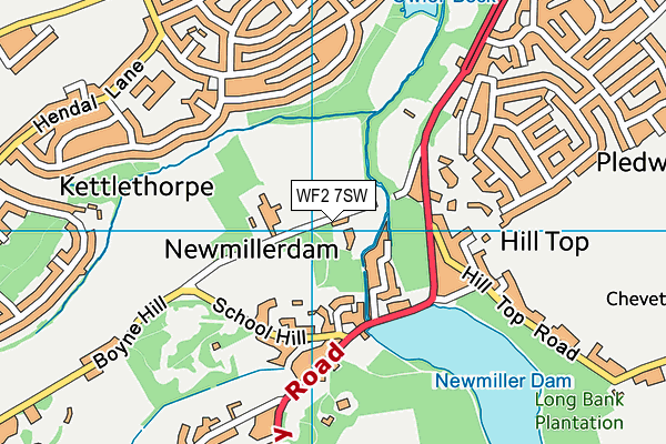
Where is Slack Lane?
| Sub Building Name | |
| Building Name | CRICKET PAVILION AND PLAYING FIELDS |
| Building Number | 0 |
| Dependent Thoroughfare | |
| Thoroughfare Name | SLACK LANE |
| Double Dependent Locality | |
| Dependent Locality | NEWMILLERDAM |
| PostTown | WAKEFIELD |
| Postcode | WF2 7SW |
Slack Lane on a map

Slack Lane geodata
| Easting | 433090.05 |
| Northing | 416068.07 |
| Latitude | 53.640088 |
| Longitude | -1.500985 |
| Local Authority Name | Wakefield |
| Local Authority Code | E08000036 |
| Parliamentary Constituency Name | Wakefield |
| Parliamentary Constituency Code | E14001009 |
| Region Name | Yorkshire and the Humber |
| Region Code | E15000003 |
| Ward Name | Wakefield Rural |
| Ward Code | E05001461 |
| Output Area Code | E00060168 |
About this data
This data is open data sourced from Active Places Power and licenced under the Active Places Open Data Licence.
| toid | osgb1000032823438 |
| Created On | 14th Sep 2004 |
| Audited On | 29th Aug 2023 |
| Checked On | 29th Aug 2023 |
