Shortwood Lodge Golf Club (Closed) - Mangotsfield
Shortwood Lodge Golf Club (Closed) is located in Mangotsfield, Bristol (BS16).
| Address | Carsons Road, Mangotsfield, Bristol, BS16 9LW |
| Car Park | Yes |
| Car Park Capacity | 250 |
| Management Type | Sport Club |
| Management Group | Others |
| Owner Type | Sports Club |
| Owner Group | Sports Club |
| Education Phase | Not applicable |
| Closure Date | 27th Jun 2019 |
| Closure Reason | Redevelopment - loss due to development project (e.g. major schemes such as HS2, new roads, area regeneration or smaller local development) |
Facilities
| Closure Date | 27th Jun 2019 |
| Closure Reason | Redevelopment - loss due to development project (e.g. major schemes such as HS2, new roads, area regeneration or smaller local development) |
| Accessibility | Pay and Play |
| Management Type | Sport Club |
| Year Built | 1975 |
| Changing Rooms | Yes |
| Year Changing Rooms Refurbished | 2006 |
| Date Record Checked | 6th Apr 2020 |
| Opening Times | Dawn To Dusk |
Facility specifics
Disabled access
| Disabled Access | Yes |
| Disabled Parking | Yes |
| Finding/Reaching Entrance | Yes |
| Reception Area | Yes |
| Doorways | Yes |
| Disabled Changing Facilities | Yes |
| Activity Areas | Yes |
| Disabled Toilets | Yes |
| Social Areas | Yes |
| Spectator Areas | Yes |
| Emergency Exits | Yes |
Contact
Disabled access
Disabled access for Shortwood Lodge Golf Club (Closed)
| Disabled Access | Yes |
| Disabled Parking | Yes |
| Finding/Reaching Entrance | Yes |
| Reception Area | Yes |
| Doorways | Yes |
| Disabled Changing Facilities | Yes |
| Activity Areas | Yes |
| Disabled Toilets | Yes |
| Social Areas | Yes |
| Spectator Areas | Yes |
| Emergency Exits | Yes |
Where is Shortwood Lodge Golf Club (Closed)?
| Sub Building Name | |
| Building Name | |
| Building Number | 0 |
| Dependent Thoroughfare | |
| Thoroughfare Name | CARSONS ROAD |
| Double Dependent Locality | |
| Dependent Locality | MANGOTSFIELD |
| PostTown | BRISTOL |
| Postcode | BS16 9LW |
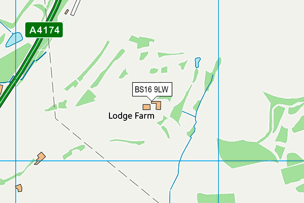
Shortwood Lodge Golf Club (Closed) on a map

Shortwood Lodge Golf Club (Closed) geodata
| Easting | 367123 |
| Northing | 175030 |
| Latitude | 51.47327 |
| Longitude | -2.474747 |
| Local Authority Name | South Gloucestershire |
| Local Authority Code | E06000025 |
| Parliamentary Constituency Name | Kingswood |
| Parliamentary Constituency Code | E14000774 |
| Region Name | South West |
| Region Code | E15000009 |
| Ward Name | Boyd Valley |
| Ward Code | E05012105 |
| Output Area Code | E00173055 |
About this data
This data is open data sourced from Active Places Power and licenced under the Active Places Open Data Licence.
| toid | osgb1000015337918 |
| Created On | 26th Apr 2004 |
| Audited On | 6th Apr 2020 |
| Checked On | 6th Apr 2020 |
