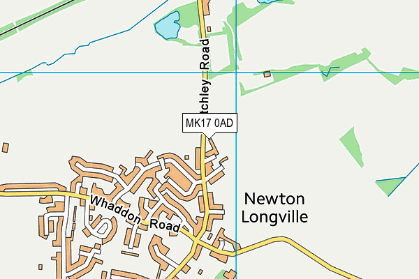
Shanks (Closed) - Newton Longville
Shanks (Closed) is located in Newton Longville, Milton Keynes (MK17).
| Address | Bletchley Road, Newton Longville, Milton Keynes, MK17 0AD |
| Car Park | Yes |
| Car Park Capacity | 30 |
| Management Type | Sport Club |
| Management Group | Others |
| Owner Type | Sports Club |
| Owner Group | Sports Club |
| Education Phase | Not applicable |
| Closure Date | 1st Aug 2017 |
| Closure Reason | Strategic Review - facility/site not being replaced |
Facilities
| Closure Date | 1st Aug 2017 |
| Closure Reason | Strategic Review - facility/site not being replaced |
| Accessibility | Sports Club / Community Association |
| Management Type | Sport Club |
| Changing Rooms | No |
| Date Record Checked | 1st Aug 2017 |
| Opening Times | Dawn To Dusk |
Facility specifics
Disabled access
| Disabled Access | Yes |
| Activity Areas | Yes |
| Spectator Areas | Yes |
| Closure Date | 1st Aug 2017 |
| Closure Reason | Strategic Review - facility/site not being replaced |
| Accessibility | Sports Club / Community Association |
| Management Type | Sport Club |
| Changing Rooms | No |
| Date Record Checked | 1st Aug 2017 |
| Opening Times | Detailed Timings |
Facility specifics
Disabled access
| Disabled Access | Yes |
| Activity Areas | Yes |
Contact
Disabled access
Disabled access for Shanks (Closed)
| Disabled Access | Yes |
| Activity Areas | Yes |
| Spectator Areas | Yes |
Where is Shanks (Closed)?
| Sub Building Name | |
| Building Name | |
| Building Number | 0 |
| Dependent Thoroughfare | |
| Thoroughfare Name | Bletchley Road |
| Double Dependent Locality | |
| Dependent Locality | Newton Longville |
| PostTown | Milton Keynes |
| Postcode | MK17 0AD |
Shanks (Closed) on a map

Shanks (Closed) geodata
| Easting | 485134 |
| Northing | 232092 |
| Latitude | 51.980777 |
| Longitude | -0.761847 |
| Local Authority Name | Buckinghamshire |
| Local Authority Code | E06000060 |
| Parliamentary Constituency Name | Buckingham |
| Parliamentary Constituency Code | E14000608 |
| Region Name | South East |
| Region Code | E15000008 |
| Ward Name | Great Brickhill |
| Ward Code | E05013146 |
| Output Area Code | E00089309 |
About this data
This data is open data sourced from Active Places Power and licenced under the Active Places Open Data Licence.
| Created On | 16th Nov 2006 |
| Audited On | 3rd Aug 2016 |
| Checked On | 3rd Aug 2016 |
