Rodmersham Cricket Club
Rodmersham Cricket Club is located in Rodmersham, Sittingbourne (ME9), and offers Grass Pitches.
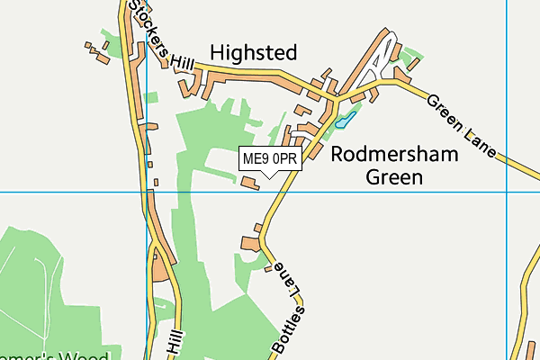
| Address | THE PAVILION, Bottles Lane, Rodmersham, Sittingbourne, ME9 0PR |
| Car Park | Yes |
| Car Park Capacity | 40 |
| Management Type | Sport Club |
| Management Group | Others |
| Owner Type | Sports Club |
| Owner Group | Sports Club |
| Education Phase | Not applicable |
Facilities
| Accessibility | Sports Club / Community Association |
| Management Type | Sport Club |
| Year Built | 1982 |
| Changing Rooms | Yes |
| Year Changing Rooms Refurbished | 2012 |
| Date Record Checked | 11th May 2023 |
| Opening Times | Dawn To Dusk |
Facility specifics
Disabled access
| Disabled Access | Yes |
| Finding/Reaching Entrance | Yes |
| Doorways | Yes |
| Activity Areas | Yes |
| Social Areas | Yes |
| Emergency Exits | Yes |
| Status Notes | Used by Local football clubs in winter months. |
| Accessibility | Sports Club / Community Association |
| Management Type | Sport Club |
| Changing Rooms | Yes |
| Year Changing Rooms Refurbished | 2012 |
| Date Record Created | 15th Aug 2016 |
| Date Record Checked | 11th May 2023 |
| Opening Times | Dawn To Dusk |
Facility specifics
Disabled access
| Disabled Access | Yes |
| Finding/Reaching Entrance | Yes |
| Doorways | Yes |
| Activity Areas | Yes |
| Social Areas | Yes |
| Emergency Exits | Yes |
Contact
Disabled access
Disabled access for Rodmersham Cricket Club
| Disabled Access | Yes |
| Finding/Reaching Entrance | Yes |
| Doorways | Yes |
| Activity Areas | Yes |
| Social Areas | Yes |
| Emergency Exits | Yes |
Where is Rodmersham Cricket Club?
| Sub Building Name | |
| Building Name | THE PAVILION |
| Building Number | 0 |
| Dependent Thoroughfare | |
| Thoroughfare Name | BOTTLES LANE |
| Double Dependent Locality | |
| Dependent Locality | RODMERSHAM |
| PostTown | SITTINGBOURNE |
| Postcode | ME9 0PR |
Rodmersham Cricket Club on a map

Rodmersham Cricket Club geodata
| Easting | 591341.41 |
| Northing | 160787.17 |
| Latitude | 51.314017 |
| Longitude | 0.744178 |
| Local Authority Name | Swale |
| Local Authority Code | E07000113 |
| Parliamentary Constituency Name | Sittingbourne and Sheppey |
| Parliamentary Constituency Code | E14000927 |
| Region Name | South East |
| Region Code | E15000008 |
| Ward Name | West Downs |
| Ward Code | E05009566 |
| Output Area Code | E00124998 |
About this data
This data is open data sourced from Active Places Power and licenced under the Active Places Open Data Licence.
| toid | osgb1000001778024 |
| Created On | 6th Dec 2009 |
| Audited On | 11th May 2023 |
| Checked On | 11th May 2023 |
