Riley Playing Fields - Kingston Upon Hull
Riley Playing Fields is located in Kingston Upon Hull (HU3), and offers Grass Pitches.
| Address | RILEY PLAYING FIELDS, Parkfield Drive, Kingston Upon Hull, HU3 6TR |
| Car Park | Yes |
| Car Park Capacity | 20 |
| Management Type | Local Authority (in house) |
| Management Group | Local Authority |
| Owner Type | Local Authority |
| Owner Group | Local Authority |
| Education Phase | Not applicable |
Facilities
| Accessibility | Sports Club / Community Association |
| Management Type | Local Authority (in house) |
| Year Refurbished | 2017 |
| Changing Rooms | No |
| Date Record Checked | 11th Apr 2023 |
| Opening Times | Dawn To Dusk |
Facility specifics
Disabled access
| Disabled Access | Yes |
| Disabled Parking | Yes |
| Activity Areas | Yes |
| Accessibility | Pay and Play |
| Management Type | Local Authority (in house) |
| Year Built | 2009 |
| Year Refurbished | 2017 |
| Changing Rooms | No |
| Date Record Checked | 11th Apr 2023 |
| Opening Times | Dawn To Dusk |
Facility specifics
Disabled access
| Disabled Access | Yes |
| Disabled Parking | Yes |
| Activity Areas | Yes |
Contact
Disabled access
Disabled access for Riley Playing Fields
| Disabled Access | Yes |
| Disabled Parking | Yes |
Where is Riley Playing Fields?
| Sub Building Name | |
| Building Name | RILEY PLAYING FIELDS |
| Building Number | 0 |
| Dependent Thoroughfare | |
| Thoroughfare Name | PARKFIELD DRIVE |
| Double Dependent Locality | |
| Dependent Locality | |
| PostTown | KINGSTON UPON HULL |
| Postcode | HU3 6TR |
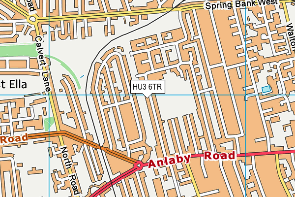
Riley Playing Fields on a map

Riley Playing Fields geodata
| Easting | 506640 |
| Northing | 428980 |
| Latitude | 53.746295 |
| Longitude | -0.384418 |
| Local Authority Name | Kingston upon Hull, City of |
| Local Authority Code | E06000010 |
| Parliamentary Constituency Name | Kingston upon Hull West and Hessle |
| Parliamentary Constituency Code | E14000773 |
| Region Name | Yorkshire and the Humber |
| Region Code | E15000003 |
| Ward Name | Boothferry |
| Ward Code | E05011527 |
| Output Area Code | E00064877 |
About this data
This data is open data sourced from Active Places Power and licenced under the Active Places Open Data Licence.
| toid | osgb1000000013273152 |
| Created On | 13th Jan 2009 |
| Audited On | 11th Apr 2023 |
| Checked On | 11th Apr 2023 |
