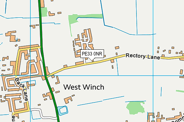
Rectory Lane Field (Closed) - West Winch
Rectory Lane Field (Closed) is located in West Winch, King's Lynn (PE33).
| Address | Rectory Lane, West Winch, King's Lynn, PE33 0NR |
| Car Park | Yes |
| Car Park Capacity | 5 |
| Management Type | Sport Club |
| Management Group | Others |
| Owner Type | Commercial |
| Owner Group | Commercial |
| Education Phase | Not Known |
| Closure Date | 7th Dec 2015 |
| Closure Reason | Strategic Review - facility/site to be replaced at existing site |
Facilities
| Closure Date | 7th Dec 2015 |
| Closure Reason | Strategic Review - facility/site to be replaced at another site |
| Accessibility | Sports Club / Community Association |
| Management Type | Sport Club |
| Year Built | 1950 |
| Year Refurbished | 2009 |
| Changing Rooms | No |
| Date Record Checked | 7th Dec 2015 |
| Opening Times | Dawn To Dusk |
Facility specifics
Disabled access
| Disabled Access | Yes |
| Activity Areas | Yes |
Disabled access
Disabled access for Rectory Lane Field (Closed)
| Disabled Access | Yes |
| Activity Areas | Yes |
Where is Rectory Lane Field (Closed)?
| Sub Building Name | |
| Building Name | |
| Building Number | 0 |
| Dependent Thoroughfare | |
| Thoroughfare Name | Rectory Lane |
| Double Dependent Locality | |
| Dependent Locality | West Winch |
| PostTown | King's Lynn |
| Postcode | PE33 0NR |
Rectory Lane Field (Closed) on a map

Rectory Lane Field (Closed) geodata
| Easting | 563228 |
| Northing | 315991 |
| Latitude | 52.716954 |
| Longitude | 0.41514 |
| Local Authority Name | King's Lynn and West Norfolk |
| Local Authority Code | E07000146 |
| Parliamentary Constituency Name | North West Norfolk |
| Parliamentary Constituency Code | E14000859 |
| Region Name | Eastern |
| Region Code | E15000006 |
| Ward Name | West Winch |
| Ward Code | E05012354 |
| Output Area Code | E00135839 |
About this data
This data is open data sourced from Active Places Power and licenced under the Active Places Open Data Licence.
| Created On | 28th Sep 2005 |
| Audited On | 26th Jan 2015 |
| Checked On | 17th Nov 2014 |
