Raw Soccer (Closed) - Lowestoft
Raw Soccer (Closed) is located in Lowestoft (NR33).
| Address | 15-17, Pinbush Road, Lowestoft, NR33 7NL |
| Car Park | Yes |
| Car Park Capacity | 25 |
| Management Type | Commercial Management |
| Management Group | Commercial |
| Owner Type | Commercial |
| Owner Group | Commercial |
| Education Phase | Not applicable |
| Closure Date | 14th Mar 2022 |
| Closure Reason | Financial - insolvency, facilities uneconomic etc |
Facilities
| Closure Date | 14th Mar 2022 |
| Closure Reason | Financial - insolvency, facilities uneconomic etc |
| Accessibility | Pay and Play |
| Management Type | Commercial Management |
| Year Built | 2010 |
| Changing Rooms | Yes |
| Date Record Created | 21st Jan 2019 |
| Date Record Checked | 11th Apr 2022 |
Opening times
| Access description | Pay and Play |
|---|
| Opening time | 10:00 |
| Closing time | 22:00 |
| Period open for | Monday-Friday |
| |
| Access description | Private Use |
|---|
| Opening time | 10:00 |
| Closing time | 20:00 |
| Period open for | Saturday |
| |
| Access description | Pay and Play |
|---|
| Opening time | 10:00 |
| Closing time | 22:00 |
| Period open for | Sunday |
Facility specifics
| Area | 600m² |
| Fill | Yes - Rubber |
| Floodlit | No |
| Indoor | Yes |
| Length | 30m |
| Pile Length | 40mm |
| Width | 20m |
| WR22 Compliant Pitch | No |
Disabled access
| Disabled Access | Yes |
| Finding/Reaching Entrance | Yes |
| Doorways | Yes |
| Activity Areas | Yes |
| Disabled Toilets | Yes |
| Social Areas | Yes |
| Emergency Exits | Yes |
Contact
Disabled access
Disabled access for Raw Soccer (Closed)
| Disabled Access | Yes |
| Finding/Reaching Entrance | Yes |
| Doorways | Yes |
| Activity Areas | Yes |
| Disabled Toilets | Yes |
| Social Areas | Yes |
| Emergency Exits | Yes |
Where is Raw Soccer (Closed)?
| Sub Building Name | |
| Building Name | 15-17 |
| Building Number | 0 |
| Dependent Thoroughfare | |
| Thoroughfare Name | PINBUSH ROAD |
| Double Dependent Locality | |
| Dependent Locality | |
| PostTown | LOWESTOFT |
| Postcode | NR33 7NL |
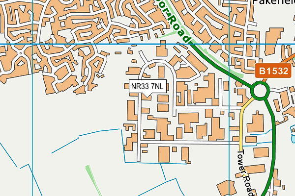
Raw Soccer (Closed) on a map

Raw Soccer (Closed) geodata
| Easting | 652672 |
| Northing | 289781 |
| Latitude | 52.447509 |
| Longitude | 1.716871 |
| Local Authority Name | East Suffolk |
| Local Authority Code | E07000244 |
| Parliamentary Constituency Name | Waveney |
| Parliamentary Constituency Code | E14001022 |
| Region Name | Eastern |
| Region Code | E15000006 |
| Ward Name | Carlton Colville |
| Ward Code | E05012739 |
| Output Area Code | E00154298 |
About this data
This data is open data sourced from Active Places Power and licenced under the Active Places Open Data Licence.
| toid | osgb1000002643086190 |
| Created On | 21st Jan 2019 |
| Audited On | 11th Dec 2020 |
| Checked On | 5th Jan 2021 |
