Ravenscourt Park - London
Ravenscourt Park is located in London (W6), and offers Artificial Grass Pitch, and Outdoor Tennis Courts.
| Address | Ravenscourt Park, London, W6 0TJ |
| Management Type | Private Contractor (PPP/PFI) |
| Management Group | Others |
| Owner Type | Local Authority |
| Owner Group | Local Authority |
| Education Phase | Not applicable |
Facilities
| Status Notes | Marked for Tennis and Netball.
|
| Accessibility | Sports Club / Community Association |
| Management Type | Private Contractor (PPP/PFI) |
| Year Built | 2005 |
| Year Refurbished | 2018 |
| Changing Rooms | No |
| Date Record Checked | 18th Sep 2023 |
| Opening Times | Dawn To Dusk |
Facility specifics
| Area | 6000m² |
| Floodlit | No |
| Indoor | No |
| Length | 100m |
| Width | 60m |
| WR22 Compliant Pitch | No |
Disabled access
| Disabled Access | Yes |
| Finding/Reaching Entrance | Yes |
| Activity Areas | Yes |
| Emergency Exits | Yes |
| Status Notes | 7 tarmac courts. Courts 4-7 are located at the South of the Park & Courts 1-3 are located at the North of the park. |
| Accessibility | Pay and Play |
| Management Type | Private Contractor (PPP/PFI) |
| Year Built | 1999 |
| Year Refurbished | 2018 |
| Changing Rooms | No |
| Date Record Checked | 18th Sep 2023 |
| Opening Times | Dawn To Dusk |
Facility specifics
| Floodlit | No |
| Overmarked | No |
| Surface Type | Macadam |
Disabled access
| Disabled Access | Yes |
| Finding/Reaching Entrance | Yes |
| Doorways | Yes |
| Activity Areas | Yes |
| Emergency Exits | Yes |
Contact
Disabled access
Disabled access for Ravenscourt Park
| Disabled Access | Yes |
| Finding/Reaching Entrance | Yes |
| Doorways | Yes |
| Activity Areas | Yes |
| Emergency Exits | Yes |
Where is Ravenscourt Park?
| Sub Building Name | |
| Building Name | |
| Building Number | 0 |
| Dependent Thoroughfare | |
| Thoroughfare Name | RAVENSCOURT PARK |
| Double Dependent Locality | |
| Dependent Locality | |
| PostTown | LONDON |
| Postcode | W6 0TJ |
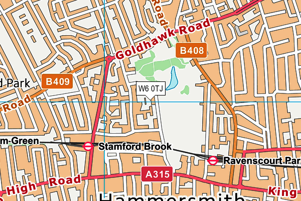
Ravenscourt Park on a map

Ravenscourt Park geodata
| Easting | 522221.13 |
| Northing | 179064.56 |
| Latitude | 51.497318 |
| Longitude | -0.240697 |
| Local Authority Name | Hammersmith and Fulham |
| Local Authority Code | E09000013 |
| Parliamentary Constituency Name | Hammersmith |
| Parliamentary Constituency Code | E14000726 |
| Region Name | London |
| Region Code | E15000007 |
| Ward Name | Ravenscourt |
| Ward Code | E05013746 |
| Output Area Code | E00009664 |
About this data
This data is open data sourced from Active Places Power and licenced under the Active Places Open Data Licence.
| Created On | 5th Jun 2009 |
| Audited On | 18th Sep 2023 |
| Checked On | 18th Sep 2023 |
