Powerleague Wembley (Closed)
Powerleague Wembley (Closed) is located in Wembley (HA9).
| Address | Olympic Way, Wembley, HA9 0FF |
| Management Type | Commercial Management |
| Management Group | Commercial |
| Owner Type | Commercial |
| Owner Group | Commercial |
| Education Phase | Not applicable |
| Closure Date | 1st Jan 2017 |
| Closure Reason | Redevelopment - loss due to development project (e.g. major schemes such as HS2, new roads, area regeneration or smaller local development) |
Facilities
| Closure Date | 1st Jan 2017 |
| Closure Reason | Redevelopment - loss due to development project (e.g. major schemes such as HS2, new roads, area regeneration or smaller local development) |
| Accessibility | Pay and Play |
| Management Type | Commercial Management |
| Year Built | 2017 |
| Changing Rooms | Yes |
| Date Record Created | 23rd Feb 2018 |
| Date Record Checked | 27th May 2021 |
Opening times
| Access description | Pay and Play |
|---|
| Opening time | 09:00 |
| Closing time | 23:00 |
| Period open for | Monday-Friday |
| |
| Access description | Pay and Play |
|---|
| Opening time | 09:00 |
| Closing time | 23:00 |
| Period open for | Sunday |
| |
| Access description | Pay and Play |
|---|
| Opening time | 09:00 |
| Closing time | 18:00 |
| Period open for | Saturday |
Facility specifics
| Area | 600m² |
| Fill | Yes - Rubber |
| Floodlit | Yes |
| Indoor | No |
| Length | 30m |
| Pile Length | 30mm |
| Width | 20m |
| WR22 Compliant Pitch | No |
Contact
Disabled access
Disabled access for Powerleague Wembley (Closed)
| Disabled Access | Yes |
| Disabled Parking | Yes |
| Finding/Reaching Entrance | Yes |
| Reception Area | Yes |
| Doorways | Yes |
| Disabled Changing Facilities | Yes |
| Activity Areas | Yes |
| Disabled Toilets | Yes |
| Social Areas | Yes |
| Spectator Areas | Yes |
Where is Powerleague Wembley (Closed)?
| Sub Building Name | |
| Building Name | |
| Building Number | 0 |
| Dependent Thoroughfare | |
| Thoroughfare Name | OLYMPIC WAY |
| Double Dependent Locality | |
| Dependent Locality | |
| PostTown | WEMBLEY |
| Postcode | HA9 0FF |
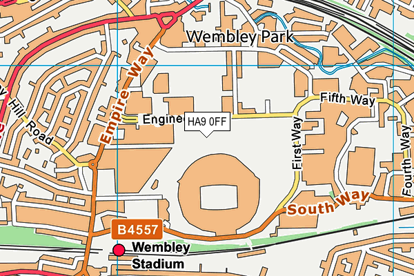
Powerleague Wembley (Closed) on a map

Powerleague Wembley (Closed) geodata
| Easting | 519329.76 |
| Northing | 185735.75 |
| Latitude | 51.557892 |
| Longitude | -0.280071 |
| Local Authority Name | Brent |
| Local Authority Code | E09000005 |
| Parliamentary Constituency Name | Brent Central |
| Parliamentary Constituency Code | E14000591 |
| Region Name | London |
| Region Code | E15000007 |
| Ward Name | Wembley Park |
| Ward Code | E05013516 |
| Output Area Code | E00174722 |
About this data
This data is open data sourced from Active Places Power and licenced under the Active Places Open Data Licence.
| toid | osgb5000005203255932 |
| Created On | 23rd Feb 2018 |
| Audited On | 2nd Apr 2020 |
| Checked On | 25th May 2021 |
