Poverty Lane Playing Fields (Closed) - Maghull
Poverty Lane Playing Fields (Closed) is located in Maghull, Liverpool (L31).
| Address | Poverty Lane, Maghull, Liverpool, L31 3DT |
| Car Park | Yes |
| Car Park Capacity | 11 |
| Management Type | Sport Club |
| Management Group | Others |
| Owner Type | Local Authority |
| Owner Group | Local Authority |
| Education Phase | Not Known |
| Closure Date | 1st Jan 2002 |
| Closure Reason | Unclassified |
Facilities
| Closure Date | 1st Jan 2002 |
| Accessibility | Pay and Play |
| Management Type | Not Known |
| Year Built | 1966 |
| Changing Rooms | No |
| Date Record Checked | 24th Sep 2009 |
| Opening Times | Detailed Timings |
Facility specifics
Where is Poverty Lane Playing Fields (Closed)?
| Sub Building Name | |
| Building Name | |
| Building Number | 0 |
| Dependent Thoroughfare | |
| Thoroughfare Name | Poverty Lane |
| Double Dependent Locality | |
| Dependent Locality | Maghull |
| PostTown | Liverpool |
| Postcode | L31 3DT |
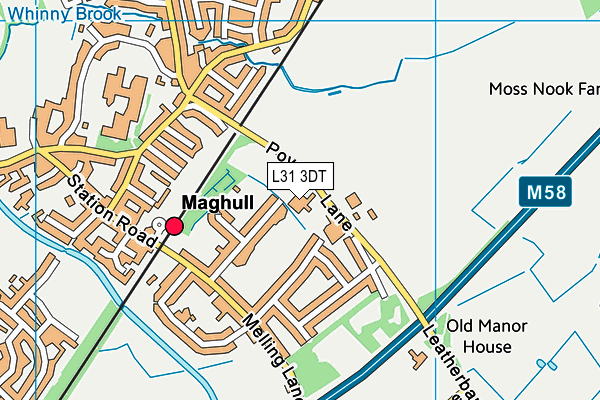
Poverty Lane Playing Fields (Closed) on a map

Poverty Lane Playing Fields (Closed) geodata
| Easting | 338738.52 |
| Northing | 401177.17 |
| Latitude | 53.503701 |
| Longitude | -2.925085 |
| Local Authority Name | Sefton |
| Local Authority Code | E08000014 |
| Parliamentary Constituency Name | Sefton Central |
| Parliamentary Constituency Code | E14000916 |
| Region Name | North West |
| Region Code | E15000002 |
| Ward Name | Sudell |
| Ward Code | E05000952 |
| Output Area Code | E00035944 |
About this data
This data is open data sourced from Active Places Power and licenced under the Active Places Open Data Licence.
| Created On | 16th Nov 2006 |
| Audited On | 26th Jan 2015 |
| Checked On | 24th Sep 2009 |
