Park Centre (Closed) - Dagenham
Park Centre (Closed) is located in Dagenham (RM10).
| Address | Rectory Road, Dagenham, RM10 9SA |
| Car Park | Yes |
| Car Park Capacity | 6 |
| Management Type | Local Authority (in house) |
| Management Group | Local Authority |
| Owner Type | Local Authority |
| Owner Group | Local Authority |
| Education Phase | Not applicable |
| Closure Date | 3rd Nov 2019 |
| Closure Reason | Strategic Review - facility/site not being replaced |
Facilities
| Closure Date | 3rd Nov 2019 |
| Closure Reason | Strategic Review - facility/site not being replaced |
| Accessibility | Registered Membership use |
| Management Type | Local Authority (in house) |
| Year Built | 2015 |
| Changing Rooms | No |
| Date Record Created | 11th Jan 2016 |
| Date Record Checked | 3rd Mar 2020 |
Opening times
| Access description | Registered Membership use |
|---|
| Opening time | 17:00 |
| Closing time | 22:00 |
| Period open for | Monday-Friday |
| |
| Access description | Registered Membership use |
|---|
| Opening time | 09:00 |
| Closing time | 14:00 |
| Period open for | Weekend |
Facility specifics
Disabled access
| Disabled Access | Yes |
| Disabled Parking | Yes |
| Finding/Reaching Entrance | Yes |
| Reception Area | Yes |
| Doorways | Yes |
| Activity Areas | Yes |
| Disabled Toilets | Yes |
| Social Areas | Yes |
| Spectator Areas | Yes |
| Emergency Exits | Yes |
Contact
Disabled access
Disabled access for Park Centre (Closed)
| Disabled Access | Yes |
| Disabled Parking | Yes |
| Finding/Reaching Entrance | Yes |
| Reception Area | Yes |
| Doorways | Yes |
| Activity Areas | Yes |
| Disabled Toilets | Yes |
| Social Areas | Yes |
| Spectator Areas | Yes |
| Emergency Exits | Yes |
Where is Park Centre (Closed)?
| Sub Building Name | |
| Building Name | |
| Building Number | 0 |
| Dependent Thoroughfare | |
| Thoroughfare Name | RECTORY ROAD |
| Double Dependent Locality | |
| Dependent Locality | |
| PostTown | DAGENHAM |
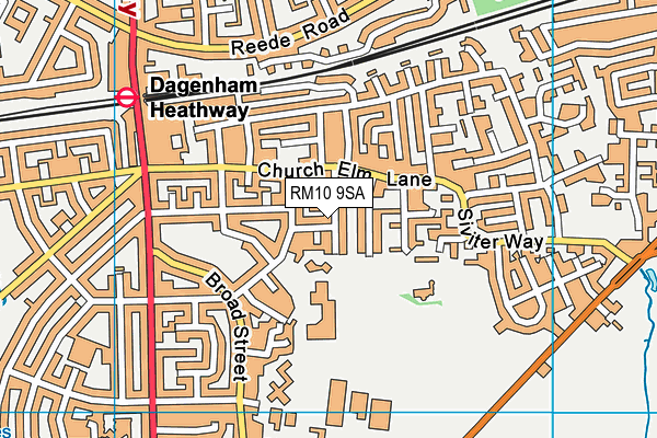
| Postcode | RM10 9SA |
Park Centre (Closed) on a map

Park Centre (Closed) geodata
| Easting | 549485.58 |
| Northing | 184477.78 |
| Latitude | 51.539411 |
| Longitude | 0.154093 |
| Local Authority Name | Barking and Dagenham |
| Local Authority Code | E09000002 |
| Parliamentary Constituency Name | Dagenham and Rainham |
| Parliamentary Constituency Code | E14000657 |
| Region Name | London |
| Region Code | E15000007 |
| Ward Name | Village |
| Ward Code | E05014070 |
| Output Area Code | E00000533 |
About this data
This data is open data sourced from Active Places Power and licenced under the Active Places Open Data Licence.
| Created On | 11th Jan 2016 |
| Audited On | 7th Mar 2019 |
| Checked On | 7th Mar 2019 |
