Nottingham Trent University (City Campus O2 Max Gym) (Closed)
Nottingham Trent University (City Campus O2 Max Gym) (Closed) is located in Nottingham (NG1).
| Address | Goldsmith Street, Nottingham, NG1 5LT |
| Management Type | School/College/University (in house) |
| Management Group | Education |
| Owner Type | Higher Education Institutions |
| Owner Group | Education |
| Education Phase | Not applicable |
| Closure Date | 1st Sep 2013 |
| Closure Reason | Unclassified |
Facilities
| Closure Date | 1st Sep 2013 |
| Closure Reason | Unclassified |
| Accessibility | Pay and Play |
| Management Type | Not Known |
| Year Built | 2002 |
| Year Refurbished | 2013 |
| Changing Rooms | Yes |
| Year Changing Rooms Refurbished | 2013 |
| Date Record Checked | 30th Apr 2014 |
| Opening Times | Detailed Timings |
Facility specifics
| Closure Date | 1st Sep 2013 |
| Closure Reason | Unclassified |
| Accessibility | Pay and Play |
| Management Type | Not Known |
| Year Built | 2002 |
| Changing Rooms | Yes |
| Year Changing Rooms Refurbished | 2008 |
| Date Record Checked | 30th Apr 2014 |
| Opening Times | Detailed Timings |
Facility specifics
| Area | 0m² |
| Floor Matting | Don't Know |
| Gymnastics Trampoline Use | Don't Know |
| Length | 0m |
| Moveable Balance Apparatus | Don't Know |
| Moveable Large Apparatus | Don't Know |
| Moveable Rebound Apparatus | Don't Know |
| Moveable Trampolines | Don't Know |
| Small Apparatus | Don't Know |
| Swinging and Hanging Apparatus | Don't Know |
| Width | 0m |
Contact
Where is Nottingham Trent University (City Campus O2 Max Gym) (Closed)?
| Sub Building Name | |
| Building Name | |
| Building Number | 0 |
| Dependent Thoroughfare | |
| Thoroughfare Name | Goldsmith Street |
| Double Dependent Locality | |
| Dependent Locality | |
| PostTown | Nottingham |
| Postcode | NG1 5LT |
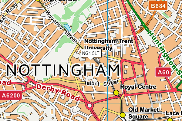
Nottingham Trent University (City Campus O2 Max Gym) (Closed) on a map

Nottingham Trent University (City Campus O2 Max Gym) (Closed) geodata
| Easting | 457012 |
| Northing | 340337 |
| Latitude | 52.957384 |
| Longitude | -1.152773 |
| Local Authority Name | Nottingham |
| Local Authority Code | E06000018 |
| Parliamentary Constituency Name | Nottingham East |
| Parliamentary Constituency Code | E14000865 |
| Region Name | East Midlands |
| Region Code | E15000004 |
| Ward Name | Hyson Green & Arboretum |
| Ward Code | E05012281 |
| Output Area Code | E00069679 |
About this data
This data is open data sourced from Active Places Power and licenced under the Active Places Open Data Licence.
| Created On | 18th May 2004 |
| Audited On | 26th Jan 2015 |
| Checked On | 30th Apr 2014 |
