Northbrooks - Harlow
Northbrooks is located in Harlow (CM19), and offers Grass Pitches.
| Address | Harberts Road, Harlow, CM19 4DU |
| Car Park | Yes |
| Car Park Capacity | 25 |
| Management Type | Local Authority (in house) |
| Management Group | Local Authority |
| Owner Type | Local Authority |
| Owner Group | Local Authority |
| Education Phase | Not Known |
Facilities
| Closure Date | 5th May 2021 |
| Closure Reason | Strategic Review - facility/site not being replaced |
| Accessibility | Sports Club / Community Association |
| Management Type | Local Authority (in house) |
| Changing Rooms | Yes |
| Year Changing Rooms Refurbished | 2007 |
| Date Record Checked | 13th Jun 2023 |
| Opening Times | Dawn To Dusk |
Facility specifics
Disabled access
| Disabled Access | Yes |
| Finding/Reaching Entrance | Yes |
| Doorways | Yes |
| Emergency Exits | Yes |
| Accessibility | Free Public Access |
| Management Type | Local Authority (in house) |
| Changing Rooms | Yes |
| Year Changing Rooms Refurbished | 2007 |
| Date Record Checked | 13th Jun 2023 |
| Opening Times | Dawn To Dusk |
Facility specifics
Disabled access
| Disabled Access | Yes |
| Finding/Reaching Entrance | Yes |
| Doorways | Yes |
| Emergency Exits | Yes |
| Closure Date | 1st Jan 2009 |
| Closure Reason | Unclassified |
| Accessibility | Pay and Play |
| Management Type | Not Known |
| Changing Rooms | No |
| Date Record Checked | 13th Jun 2023 |
| Opening Times | Detailed Timings |
Facility specifics
| Floodlit | Yes |
| Overmarked | No |
| Surface Type | Macadam |
Contact
Disabled access
Disabled access for Northbrooks
| Disabled Access | Yes |
| Finding/Reaching Entrance | Yes |
| Doorways | Yes |
| Emergency Exits | Yes |
Where is Northbrooks?
| Sub Building Name | |
| Building Name | |
| Building Number | 0 |
| Dependent Thoroughfare | |
| Thoroughfare Name | Harberts Road |
| Double Dependent Locality | |
| Dependent Locality | |
| PostTown | Harlow |
| Postcode | CM19 4DU |
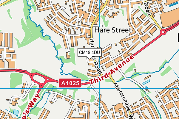
Northbrooks on a map

Northbrooks geodata
| Easting | 544030.99 |
| Northing | 209499.04 |
| Latitude | 51.765651 |
| Longitude | 0.085794 |
| Local Authority Name | Harlow |
| Local Authority Code | E07000073 |
| Parliamentary Constituency Name | Harlow |
| Parliamentary Constituency Code | E14000729 |
| Region Name | Eastern |
| Region Code | E15000006 |
| Ward Name | Little Parndon and Hare Street |
| Ward Code | E05004183 |
| Output Area Code | E00110962 |
About this data
This data is open data sourced from Active Places Power and licenced under the Active Places Open Data Licence.
| Created On | 11th Jul 2008 |
| Audited On | 13th Jun 2023 |
| Checked On | 13th Jun 2023 |
