Normanby Hall Golf Club
Normanby Hall Golf Club is located in Normanby, Scunthorpe (DN15), and offers Golf.
| Address | NORMANBY HALL, Normanby Park, Normanby, Scunthorpe, DN15 9HU |
| Car Park | Yes |
| Car Park Capacity | 250 |
| Management Type | Local Authority (in house) |
| Management Group | Local Authority |
| Owner Type | Local Authority |
| Owner Group | Local Authority |
| Education Phase | Not applicable |
Facilities
| Closure Date | 1st Jan 2011 |
| Closure Reason | Unclassified |
| Accessibility | Registered Membership use |
| Management Type | Not Known |
| Year Built | 2005 |
| Changing Rooms | Yes |
| Year Changing Rooms Refurbished | 2015 |
| Date Record Checked | 24th Oct 2022 |
| Opening Times | Detailed Timings |
Facility specifics
| Accessibility | Pay and Play |
| Management Type | Local Authority (in house) |
| Year Built | 1978 |
| Changing Rooms | Yes |
| Year Changing Rooms Refurbished | 2015 |
| Date Record Checked | 24th Oct 2022 |
| Opening Times | Dawn To Dusk |
Facility specifics
Disabled access
| Disabled Access | Yes |
| Disabled Parking | Yes |
| Finding/Reaching Entrance | Yes |
| Reception Area | Yes |
| Doorways | Yes |
| Disabled Changing Facilities | Yes |
| Activity Areas | Yes |
| Disabled Toilets | Yes |
| Social Areas | Yes |
| Spectator Areas | Yes |
| Emergency Exits | Yes |
Contact
Disabled access
Disabled access for Normanby Hall Golf Club
| Disabled Access | Yes |
| Disabled Parking | Yes |
| Finding/Reaching Entrance | Yes |
| Reception Area | Yes |
| Doorways | Yes |
| Disabled Changing Facilities | Yes |
| Activity Areas | Yes |
| Disabled Toilets | Yes |
| Social Areas | Yes |
| Spectator Areas | Yes |
| Emergency Exits | Yes |
Where is Normanby Hall Golf Club?
| Sub Building Name | |
| Building Name | NORMANBY HALL |
| Building Number | 0 |
| Dependent Thoroughfare | |
| Thoroughfare Name | NORMANBY PARK |
| Double Dependent Locality | |
| Dependent Locality | NORMANBY |
| PostTown | SCUNTHORPE |
| Postcode | DN15 9HU |
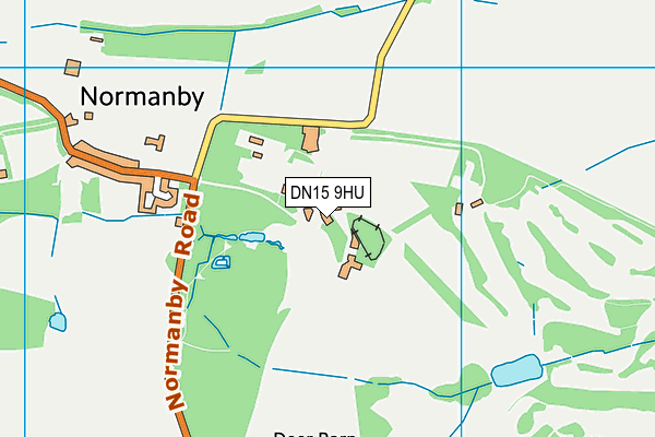
Normanby Hall Golf Club on a map

Normanby Hall Golf Club geodata
| Easting | 488733 |
| Northing | 416536 |
| Latitude | 53.637829 |
| Longitude | -0.659422 |
| Local Authority Name | North Lincolnshire |
| Local Authority Code | E06000013 |
| Parliamentary Constituency Name | Brigg and Goole |
| Parliamentary Constituency Code | E14000596 |
| Region Name | Yorkshire and the Humber |
| Region Code | E15000003 |
| Ward Name | Burton upon Stather and Winterton |
| Ward Code | E05001738 |
| Output Area Code | E00067065 |
About this data
This data is open data sourced from Active Places Power and licenced under the Active Places Open Data Licence.
| toid | osgb1000033888256 |
| Created On | 26th Apr 2004 |
| Audited On | 24th Oct 2022 |
| Checked On | 24th Oct 2022 |
