Moulsford Recreation Ground
Moulsford Recreation Ground is located in Moulsford, Wallingford (OX10), and offers Grass Pitches.
| Address | MOULSFORD RECREATION GROUND, Reading Road, Moulsford, Wallingford, OX10 9JD |
| Car Park | Yes |
| Car Park Capacity | 14 |
| Management Type | Local Authority (in house) |
| Management Group | Local Authority |
| Owner Type | Local Authority |
| Owner Group | Local Authority |
| Education Phase | Not Known |
Facilities
| Accessibility | Sports Club / Community Association |
| Management Type | Local Authority (in house) |
| Year Built | 1950 |
| Changing Rooms | Yes |
| Year Changing Rooms Refurbished | 2011 |
| Date Record Checked | 23rd Aug 2023 |
| Opening Times | Dawn To Dusk |
Facility specifics
Disabled access
| Notes | No disability access |
| Closure Date | 21st Feb 2020 |
| Closure Reason | Strategic Review - facility/site not being replaced |
| Accessibility | Sports Club / Community Association |
| Management Type | Local Authority (in house) |
| Year Built | 2000 |
| Changing Rooms | Yes |
| Date Record Created | 22nd Nov 2017 |
| Date Record Checked | 23rd Aug 2023 |
| Opening Times | Dawn To Dusk |
Facility specifics
| Floodlit | No |
| Overmarked | No |
| Surface Type | Macadam |
| Accessibility | Sports Club / Community Association |
| Management Type | Local Authority (in house) |
| Changing Rooms | Yes |
| Date Record Created | 21st Feb 2020 |
| Date Record Checked | 23rd Aug 2023 |
| Opening Times | Dawn To Dusk |
Facility specifics
Disabled access
| Notes | No disability access |
Contact
Disabled access
Disabled access for Moulsford Recreation Ground
| Notes | No disability access |
Where is Moulsford Recreation Ground?
| Sub Building Name | |
| Building Name | MOULSFORD RECREATION GROUND |
| Building Number | 0 |
| Dependent Thoroughfare | |
| Thoroughfare Name | READING ROAD |
| Double Dependent Locality | |
| Dependent Locality | MOULSFORD |
| PostTown | WALLINGFORD |
| Postcode | OX10 9JD |
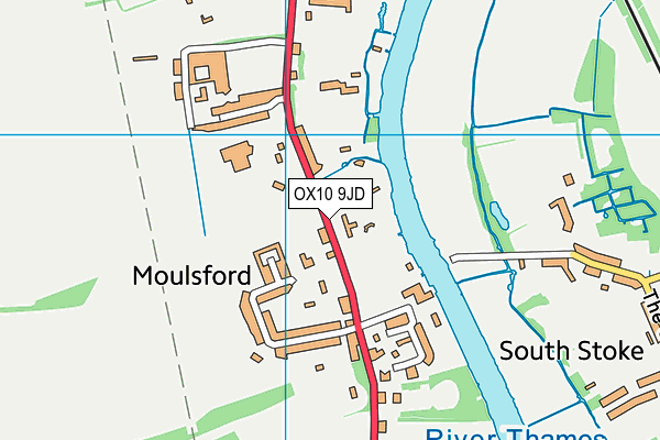
Moulsford Recreation Ground on a map

Moulsford Recreation Ground geodata
| Easting | 458989.14 |
| Northing | 183880.88 |
| Latitude | 51.550742 |
| Longitude | -1.150635 |
| Local Authority Name | South Oxfordshire |
| Local Authority Code | E07000179 |
| Parliamentary Constituency Name | Wantage |
| Parliamentary Constituency Code | E14001015 |
| Region Name | South East |
| Region Code | E15000008 |
| Ward Name | Cholsey |
| Ward Code | E05011701 |
| Output Area Code | E00145779 |
About this data
This data is open data sourced from Active Places Power and licenced under the Active Places Open Data Licence.
| Created On | 23rd Oct 2009 |
| Audited On | 23rd Aug 2023 |
| Checked On | 23rd Aug 2023 |
