Millfields Park - London
Millfields Park is located in London (E5), and offers Grass Pitches, and Outdoor Tennis Courts.
| Address | Wattisfield Road, London, E5 9QH |
| Management Type | Local Authority (in house) |
| Management Group | Local Authority |
| Owner Type | Local Authority |
| Owner Group | Local Authority |
| Education Phase | Not applicable |
Facilities
| Accessibility | Pay and Play |
| Management Type | Local Authority (in house) |
| Changing Rooms | No |
| Date Record Checked | 8th Feb 2023 |
| Opening Times | Dawn To Dusk |
Facility specifics
Disabled access
| Disabled Access | Yes |
| Finding/Reaching Entrance | Yes |
| Activity Areas | Yes |
| Spectator Areas | Yes |
| Accessibility | Pay and Play |
| Management Type | Local Authority (in house) |
| Year Built | 1985 |
| Year Refurbished | 2015 |
| Changing Rooms | No |
| Date Record Checked | 8th Feb 2023 |
| Opening Times | Dawn To Dusk |
Facility specifics
| Floodlit | No |
| Overmarked | No |
| Surface Type | Macadam |
Disabled access
| Disabled Access | Yes |
| Finding/Reaching Entrance | Yes |
| Activity Areas | Yes |
| Spectator Areas | Yes |
| Accessibility | Pay and Play |
| Management Type | Local Authority (in house) |
| Changing Rooms | No |
| Date Record Checked | 8th Feb 2023 |
| Opening Times | Dawn To Dusk |
Facility specifics
Disabled access
| Disabled Access | Yes |
| Finding/Reaching Entrance | Yes |
| Activity Areas | Yes |
| Spectator Areas | Yes |
Contact
Disabled access
Disabled access for Millfields Park
| Disabled Access | Yes |
| Finding/Reaching Entrance | Yes |
| Activity Areas | Yes |
| Spectator Areas | Yes |
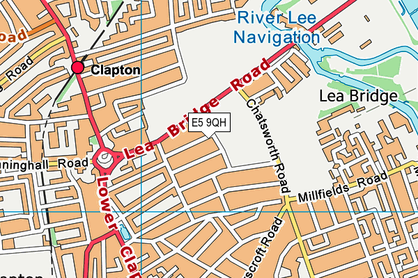
Where is Millfields Park?
| Sub Building Name | |
| Building Name | |
| Building Number | 0 |
| Dependent Thoroughfare | |
| Thoroughfare Name | WATTISFIELD ROAD |
| Double Dependent Locality | |
| Dependent Locality | |
| PostTown | LONDON |
| Postcode | E5 9QH |
Millfields Park on a map

Millfields Park geodata
| Easting | 535331.91 |
| Northing | 186318.27 |
| Latitude | 51.559518 |
| Longitude | -0.049153 |
| Local Authority Name | Hackney |
| Local Authority Code | E09000012 |
| Parliamentary Constituency Name | Hackney North and Stoke Newington |
| Parliamentary Constituency Code | E14000720 |
| Region Name | London |
| Region Code | E15000007 |
| Ward Name | Lea Bridge |
| Ward Code | E05009380 |
| Output Area Code | E00008949 |
About this data
This data is open data sourced from Active Places Power and licenced under the Active Places Open Data Licence.
| Created On | 11th Jul 2008 |
| Audited On | 8th Feb 2023 |
| Checked On | 20th Jul 2023 |
