Manor Road Playing Fields (Dawley) (Closed)
Manor Road Playing Fields (Dawley) (Closed) is located in Dawley, Telford (TF4).
| Address | PHOENIX BUNGALOW, Manor Road, Dawley, Telford, TF4 3DZ |
| Management Type | Local Authority (in house) |
| Management Group | Local Authority |
| Owner Type | Local Authority |
| Owner Group | Local Authority |
| Education Phase | Not applicable |
| Closure Date | 14th Mar 2020 |
| Closure Reason | Strategic Review - facility/site to be replaced at existing site |
Facilities
| Closure Date | 14th Mar 2020 |
| Closure Reason | Strategic Review - facility/site to be replaced at existing site |
| Accessibility | Free Public Access |
| Management Type | Local Authority (in house) |
| Changing Rooms | No |
| Date Record Created | 25th May 2016 |
| Date Record Checked | 19th Oct 2021 |
| Opening Times | Dawn To Dusk |
Facility specifics
Contact
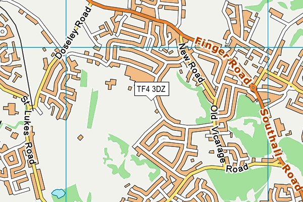
Where is Manor Road Playing Fields (Dawley) (Closed)?
| Sub Building Name | |
| Building Name | PHOENIX BUNGALOW |
| Building Number | 0 |
| Dependent Thoroughfare | |
| Thoroughfare Name | MANOR ROAD |
| Double Dependent Locality | |
| Dependent Locality | DAWLEY |
| PostTown | TELFORD |
| Postcode | TF4 3DZ |
Manor Road Playing Fields (Dawley) (Closed) on a map

Manor Road Playing Fields (Dawley) (Closed) geodata
| Easting | 368415.91 |
| Northing | 306679.01 |
| Latitude | 52.656908 |
| Longitude | -2.468359 |
| Local Authority Name | Telford and Wrekin |
| Local Authority Code | E06000020 |
| Parliamentary Constituency Name | Telford |
| Parliamentary Constituency Code | E14000989 |
| Region Name | West Midlands |
| Region Code | E15000005 |
| Ward Name | Dawley & Aqueduct |
| Ward Code | E05009972 |
| Output Area Code | E00071326 |
About this data
This data is open data sourced from Active Places Power and licenced under the Active Places Open Data Licence.
| toid | osgb1000037016474 |
| Created On | 25th May 2016 |
| Audited On | 22nd Sep 2020 |
| Checked On | 13th Oct 2021 |
