Manor Five Football Centre - Kearsley
Manor Five Football Centre is located in Kearsley, Bolton (BL4), and offers Artificial Grass Pitch.
| Address | Moss Lane, Kearsley, Bolton, BL4 8SF |
| Car Park | Yes |
| Car Park Capacity | 30 |
| Management Type | Commercial Management |
| Management Group | Commercial |
| Owner Type | Commercial |
| Owner Group | Commercial |
| Education Phase | Not applicable |
Facilities
| Status Notes | 7-a-side 3G football pitch |
| Accessibility | Pay and Play |
| Management Type | Commercial Management |
| Year Built | 2017 |
| Changing Rooms | Yes |
| Date Record Created | 6th Oct 2017 |
| Date Record Checked | 26th Jul 2023 |
Opening times
| Access description | Pay and Play |
|---|
| Opening time | 10:00 |
| Closing time | 22:00 |
| Period open for | Every day |
Facility specifics
| Area | 1435m² |
| Fill | Yes - Rubber |
| Floodlit | Yes |
| Indoor | No |
| Length | 41m |
| Pile Length | 50mm |
| Width | 35m |
| WR22 Compliant Pitch | No |
Disabled access
| Disabled Access | Yes |
| Activity Areas | Yes |
| Status Notes | two 5-a-side astroturf pitches |
| Accessibility | Pay and Play |
| Management Type | Commercial Management |
| Year Built | 2017 |
| Changing Rooms | Yes |
| Date Record Created | 6th Oct 2017 |
| Date Record Checked | 26th Jul 2023 |
Opening times
| Access description | Pay and Play |
|---|
| Opening time | 10:00 |
| Closing time | 22:00 |
| Period open for | Every day |
Facility specifics
| Area | 700m² |
| Floodlit | Yes |
| Indoor | No |
| Length | 35m |
| Width | 20m |
| WR22 Compliant Pitch | No |
Disabled access
| Disabled Access | Yes |
| Activity Areas | Yes |
Contact
Disabled access
Disabled access for Manor Five Football Centre
| Disabled Access | Yes |
| Activity Areas | Yes |
Where is Manor Five Football Centre?
| Sub Building Name | |
| Building Name | |
| Building Number | 0 |
| Dependent Thoroughfare | |
| Thoroughfare Name | MOSS LANE |
| Double Dependent Locality | |
| Dependent Locality | KEARSLEY |
| PostTown | BOLTON |
| Postcode | BL4 8SF |
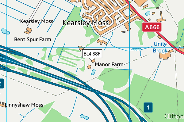
Manor Five Football Centre on a map

Manor Five Football Centre geodata
| Easting | 375808.87 |
| Northing | 403907.14 |
| Latitude | 53.531258 |
| Longitude | -2.366424 |
| Local Authority Name | Bolton |
| Local Authority Code | E08000001 |
| Parliamentary Constituency Name | Bolton South East |
| Parliamentary Constituency Code | E14000579 |
| Region Name | North West |
| Region Code | E15000002 |
| Ward Name | Kearsley |
| Ward Code | E05000663 |
| Output Area Code | E00024852 |
About this data
This data is open data sourced from Active Places Power and licenced under the Active Places Open Data Licence.
| Created On | 6th Oct 2017 |
| Audited On | 26th Jul 2023 |
| Checked On | 26th Jul 2023 |
