Malvern Squash Rackets Club (Closed)
Malvern Squash Rackets Club (Closed) is located in Malvern (WR14).
| Address | REAR OF HORNYOLD COURT, Wells Road, Malvern, WR14 4HA |
| Management Type | Sport Club |
| Management Group | Others |
| Owner Type | Sports Club |
| Owner Group | Sports Club |
| Education Phase | Not applicable |
| Closure Date | 19th Sep 2017 |
| Closure Reason | Strategic Review - facility/site not being replaced |
Facilities
| Closure Date | 19th Sep 2017 |
| Closure Reason | Strategic Review - facility/site not being replaced |
| Accessibility | Sports Club / Community Association |
| Management Type | Sport Club |
| Year Built | 1952 |
| Year Refurbished | 2009 |
| Changing Rooms | Yes |
| Date Record Checked | 27th Apr 2021 |
Opening times
| Access description | Sports Club / Community Association |
|---|
| Opening time | 09:00 |
| Closing time | 22:00 |
| Period open for | Every day |
Facility specifics
Contact
Disabled access
Disabled access for Malvern Squash Rackets Club (Closed)
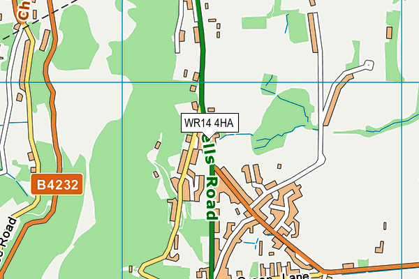
Where is Malvern Squash Rackets Club (Closed)?
| Sub Building Name | |
| Building Name | REAR OF HORNYOLD COURT |
| Building Number | 0 |
| Dependent Thoroughfare | |
| Thoroughfare Name | WELLS ROAD |
| Double Dependent Locality | |
| Dependent Locality | |
| PostTown | MALVERN |
| Postcode | WR14 4HA |
Malvern Squash Rackets Club (Closed) on a map

Malvern Squash Rackets Club (Closed) geodata
| Easting | 377342 |
| Northing | 242808 |
| Latitude | 52.083158 |
| Longitude | -2.332066 |
| Local Authority Name | Malvern Hills |
| Local Authority Code | E07000235 |
| Parliamentary Constituency Name | West Worcestershire |
| Parliamentary Constituency Code | E14001035 |
| Region Name | West Midlands |
| Region Code | E15000005 |
| Ward Name | Wells |
| Ward Code | E05007865 |
| Output Area Code | E00164346 |
About this data
This data is open data sourced from Active Places Power and licenced under the Active Places Open Data Licence.
| toid | osgb1000018796665 |
| Created On | 10th Feb 2014 |
| Audited On | 27th Apr 2021 |
| Checked On | 27th Apr 2021 |
