Lullington Park Cricket Club
Lullington Park Cricket Club is located in Lullington, Swadlincote (DE12), and offers Grass Pitches.
| Address | Lullington, Swadlincote, DE12 8ED |
| Car Park | Yes |
| Car Park Capacity | 200 |
| Management Type | Sport Club |
| Management Group | Others |
| Owner Type | Sports Club |
| Owner Group | Sports Club |
| Education Phase | Not applicable |
| Start Date | 3rd May 2018 |
Facilities
| Status Notes | Site has two grass cricket squares, one with 15 grass pitches, the other with eight grass pitches plus a non-turf/match play pitch. Additionally there are three non-turf practice pitches in net frames |
| Accessibility | Sports Club / Community Association |
| Management Type | Sport Club |
| Year Built | 1859 |
| Year Refurbished | 2004 |
| Changing Rooms | Yes |
| Year Changing Rooms Refurbished | 2006 |
| Date Record Checked | 19th Oct 2022 |
| Opening Times | Dawn To Dusk |
Facility specifics
Disabled access
| Disabled Access | Yes |
| Disabled Parking | Yes |
| Finding/Reaching Entrance | Yes |
| Doorways | Yes |
| Disabled Changing Facilities | Yes |
| Activity Areas | Yes |
| Disabled Toilets | Yes |
| Social Areas | Yes |
| Spectator Areas | Yes |
| Emergency Exits | Yes |
Contact
Disabled access
Disabled access for Lullington Park Cricket Club
| Disabled Access | Yes |
| Disabled Parking | Yes |
| Finding/Reaching Entrance | Yes |
| Doorways | Yes |
| Disabled Changing Facilities | Yes |
| Activity Areas | Yes |
| Disabled Toilets | Yes |
| Social Areas | Yes |
| Spectator Areas | Yes |
| Emergency Exits | Yes |
Where is Lullington Park Cricket Club?
| Sub Building Name | |
| Building Name | |
| Building Number | 0 |
| Dependent Thoroughfare | |
| Thoroughfare Name | |
| Double Dependent Locality | |
| Dependent Locality | LULLINGTON |
| PostTown | SWADLINCOTE |
| Postcode | DE12 8ED |
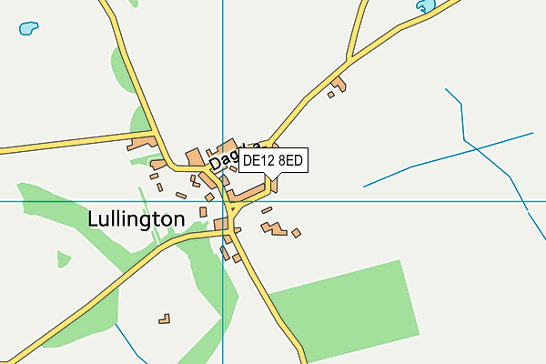
Lullington Park Cricket Club on a map

Lullington Park Cricket Club geodata
| Easting | 424893.43 |
| Northing | 312646.69 |
| Latitude | 52.710915 |
| Longitude | -1.632971 |
| Local Authority Name | South Derbyshire |
| Local Authority Code | E07000039 |
| Parliamentary Constituency Name | South Derbyshire |
| Parliamentary Constituency Code | E14000935 |
| Region Name | East Midlands |
| Region Code | E15000004 |
| Ward Name | Seales |
| Ward Code | E05008819 |
| Output Area Code | E00100547 |
About this data
This data is open data sourced from Active Places Power and licenced under the Active Places Open Data Licence.
| toid | osgb1000002610057373 |
| Created On | 15th Nov 2006 |
| Audited On | 19th Oct 2022 |
| Checked On | 19th Oct 2022 |
