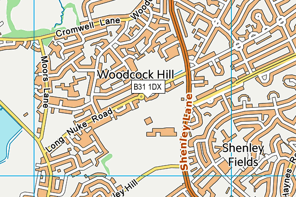
Long Nuke (Closed) - Birmingham
Long Nuke (Closed) is located in Birmingham (B31).
| Address | Long Nuke Road, Birmingham, B31 1DX |
| Management Type | Local Authority (in house) |
| Management Group | Local Authority |
| Owner Type | Local Authority |
| Owner Group | Local Authority |
| Education Phase | Not Known |
| Closure Date | 1st Nov 2016 |
| Closure Reason | Unclassified |
Facilities
| Closure Date | 1st Nov 2016 |
| Closure Reason | Unclassified |
| Accessibility | Pay and Play |
| Management Type | Local Authority (in house) |
| Changing Rooms | No |
| Date Record Checked | 2nd Nov 2016 |
| Opening Times | Dawn To Dusk |
Facility specifics
Disabled access
| Disabled Access | Yes |
| Activity Areas | Yes |
| Spectator Areas | Yes |
Contact
Disabled access
Disabled access for Long Nuke (Closed)
| Disabled Access | Yes |
| Activity Areas | Yes |
| Spectator Areas | Yes |
Where is Long Nuke (Closed)?
| Sub Building Name | |
| Building Name | |
| Building Number | 0 |
| Dependent Thoroughfare | |
| Thoroughfare Name | Long Nuke Road |
| Double Dependent Locality | |
| Dependent Locality | |
| PostTown | Birmingham |
| Postcode | B31 1DX |
Long Nuke (Closed) on a map

Long Nuke (Closed) geodata
| Easting | 401604 |
| Northing | 281540 |
| Latitude | 52.431837 |
| Longitude | -1.977835 |
| Local Authority Name | Birmingham |
| Local Authority Code | E08000025 |
| Parliamentary Constituency Name | Birmingham, Edgbaston |
| Parliamentary Constituency Code | E14000560 |
| Region Name | West Midlands |
| Region Code | E15000005 |
| Ward Name | Bartley Green |
| Ward Code | E05011123 |
| Output Area Code | E00045251 |
About this data
This data is open data sourced from Active Places Power and licenced under the Active Places Open Data Licence.
| Created On | 6th Dec 2009 |
| Audited On | 11th Sep 2015 |
| Checked On | 11th Sep 2015 |
