Londonderry Playing Fields (Closed) - Smethwick
Londonderry Playing Fields (Closed) is located in Smethwick (B67).
| Address | PAVILION, LONDONDERRY PLAYING FIELDS, Londonderry Lane, Smethwick, B67 7EP |
| Car Park | Yes |
| Car Park Capacity | 11 |
| Management Type | Local Authority (in house) |
| Management Group | Local Authority |
| Owner Type | Local Authority |
| Owner Group | Local Authority |
| Education Phase | Not applicable |
| Closure Date | 26th Nov 2019 |
| Closure Reason | Redevelopment - loss due to development project (e.g. major schemes such as HS2, new roads, area regeneration or smaller local development) |
Facilities
| Closure Date | 26th Nov 2019 |
| Closure Reason | Redevelopment - loss due to development project (e.g. major schemes such as HS2, new roads, area regeneration or smaller local development) |
| Accessibility | Pay and Play |
| Management Type | Local Authority (in house) |
| Changing Rooms | Yes |
| Date Record Checked | 8th Apr 2022 |
| Opening Times | Dawn To Dusk |
Facility specifics
| Status Notes | Re-opened on Active Places 24/05/2017
May 2017 Recoding |
| Closure Date | 26th Nov 2019 |
| Closure Reason | Redevelopment - loss due to development project (e.g. major schemes such as HS2, new roads, area regeneration or smaller local development) |
| Accessibility | Pay and Play |
| Management Type | Local Authority (in house) |
| Changing Rooms | Yes |
| Date Record Checked | 8th Apr 2022 |
| Opening Times | Dawn To Dusk |
Facility specifics
Contact
Where is Londonderry Playing Fields (Closed)?
| Sub Building Name | PAVILION |
| Building Name | LONDONDERRY PLAYING FIELDS |
| Building Number | 0 |
| Dependent Thoroughfare | |
| Thoroughfare Name | LONDONDERRY LANE |
| Double Dependent Locality | |
| Dependent Locality | |
| PostTown | SMETHWICK |
| Postcode | B67 7EP |
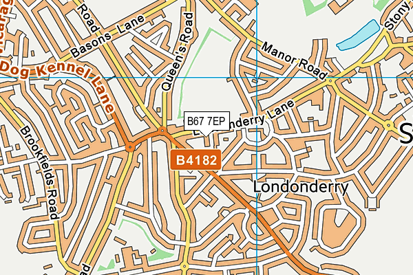
Londonderry Playing Fields (Closed) on a map

Londonderry Playing Fields (Closed) geodata
| Easting | 400815 |
| Northing | 287833 |
| Latitude | 52.488412 |
| Longitude | -1.989427 |
| Local Authority Name | Sandwell |
| Local Authority Code | E08000028 |
| Parliamentary Constituency Name | Warley |
| Parliamentary Constituency Code | E14001016 |
| Region Name | West Midlands |
| Region Code | E15000005 |
| Ward Name | Smethwick |
| Ward Code | E05001277 |
| Output Area Code | E00050683 |
About this data
This data is open data sourced from Active Places Power and licenced under the Active Places Open Data Licence.
| toid | osgb5000005279328956 |
| Created On | 11th Jul 2008 |
| Audited On | 20th May 2021 |
| Checked On | 8th Apr 2022 |
