Little Horwood Recreation Ground
Little Horwood Recreation Ground is located in Little Horwood (MK17), and offers Outdoor Tennis Courts.
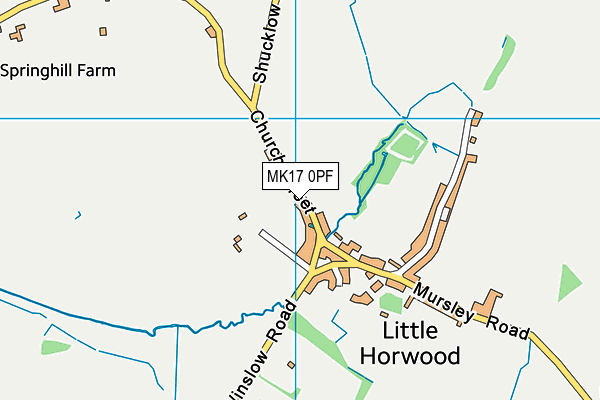
| Address | RECREATION GROUND, Church Street, Little Horwood, MK17 0PF |
| Car Park | Yes |
| Car Park Capacity | 20 |
| Management Type | Local Authority (in house) |
| Management Group | Local Authority |
| Owner Type | Local Authority |
| Owner Group | Local Authority |
| Education Phase | Not applicable |
Facilities
| Accessibility | Free Public Access |
| Management Type | Local Authority (in house) |
| Changing Rooms | No |
| Date Record Checked | 10th Nov 2022 |
| Opening Times | Dawn To Dusk |
Facility specifics
| Status Notes | MUGA- 1 Tennis court also marked out for Basketball on a concrete playing surface. |
| Accessibility | Pay and Play |
| Management Type | Local Authority (in house) |
| Year Built | 2000 |
| Year Refurbished | 2021 |
| Changing Rooms | Yes |
| Date Record Created | 7th Aug 2019 |
| Date Record Checked | 10th Nov 2022 |
| Opening Times | Dawn To Dusk |
Facility specifics
| Floodlit | No |
| Overmarked | Yes |
| Surface Type | Concrete |
Disabled access
| Disabled Access | Yes |
| Finding/Reaching Entrance | Yes |
| Reception Area | Yes |
| Doorways | Yes |
| Activity Areas | Yes |
| Disabled Toilets | Yes |
| Social Areas | Yes |
| Spectator Areas | Yes |
| Emergency Exits | Yes |
| Notes | Ramp has been put in place to allow access to the site |
Contact
Disabled access
Disabled access for Little Horwood Recreation Ground
| Disabled Access | Yes |
| Finding/Reaching Entrance | Yes |
| Reception Area | Yes |
| Doorways | Yes |
| Activity Areas | Yes |
| Disabled Toilets | Yes |
| Social Areas | Yes |
| Spectator Areas | Yes |
| Emergency Exits | Yes |
| Notes | Ramp has been put in place to allow access to the site |
Where is Little Horwood Recreation Ground?
| Sub Building Name | |
| Building Name | RECREATION GROUND |
| Building Number | 0 |
| Dependent Thoroughfare | |
| Thoroughfare Name | CHURCH STREET |
| Double Dependent Locality | |
| Dependent Locality | |
| PostTown | LITTLE HORWOOD |
| Postcode | MK17 0PF |
Little Horwood Recreation Ground on a map

Little Horwood Recreation Ground geodata
| Easting | 479120 |
| Northing | 230906 |
| Latitude | 51.971004 |
| Longitude | -0.849665 |
| Local Authority Name | Buckinghamshire |
| Local Authority Code | E06000060 |
| Parliamentary Constituency Name | Buckingham |
| Parliamentary Constituency Code | E14000608 |
| Region Name | South East |
| Region Code | E15000008 |
| Ward Name | Winslow |
| Ward Code | E05013168 |
| Output Area Code | E00089198 |
About this data
This data is open data sourced from Active Places Power and licenced under the Active Places Open Data Licence.
| Created On | 16th Nov 2006 |
| Audited On | 10th Nov 2022 |
| Checked On | 10th Nov 2022 |
