Lewes Fc (The Rookery 3g)
Lewes Fc (The Rookery 3g) is located in Lewes (BN7), and offers Artificial Grass Pitch.
| Address | Ham Lane, Lewes, BN7 2XA |
| Car Park | Yes |
| Car Park Capacity | 40 |
| Management Type | Sport Club |
| Management Group | Others |
| Owner Type | Local Authority |
| Owner Group | Local Authority |
| Education Phase | Not applicable |
Aliases
Lewes Fc (The Rookery 3g) is also known as:
Facilities
| Status Notes | The Rookery 3G |
| Accessibility | Sports Club / Community Association |
| Management Type | Sport Club |
| Year Built | 2015 |
| Changing Rooms | Yes |
| Date Record Created | 15th Jul 2016 |
| Date Record Checked | 17th Feb 2023 |
Opening times
| Access description | Sports Club / Community Association |
|---|
| Opening time | 18:00 |
| Closing time | 22:00 |
| Period open for | Tuesday |
| |
| Access description | Sports Club / Community Association |
|---|
| Opening time | 10:00 |
| Closing time | 19:00 |
| Period open for | Weekend |
| |
| Access description | Sports Club / Community Association |
|---|
| Opening time | 18:00 |
| Closing time | 22:00 |
| Period open for | Thursday |
Facility specifics
| Area | 7597m² |
| Fill | Yes - Rubber |
| Floodlit | Yes |
| Indoor | No |
| Length | 107m |
| Pile Length | 40mm |
| Width | 71m |
| WR22 Compliant Pitch | No |
Disabled access
| Disabled Access | Yes |
| Disabled Parking | Yes |
| Finding/Reaching Entrance | Yes |
| Reception Area | Yes |
| Doorways | Yes |
| Activity Areas | Yes |
| Disabled Toilets | Yes |
| Social Areas | Yes |
| Spectator Areas | Yes |
| Emergency Exits | Yes |
Contact
Disabled access
Disabled access for Lewes Fc (The Rookery 3g)
| Disabled Access | Yes |
| Disabled Parking | Yes |
| Finding/Reaching Entrance | Yes |
| Reception Area | Yes |
| Doorways | Yes |
| Activity Areas | Yes |
| Disabled Toilets | Yes |
| Social Areas | Yes |
| Spectator Areas | Yes |
| Emergency Exits | Yes |
Where is Lewes Fc (The Rookery 3g)?
| Sub Building Name | |
| Building Name | |
| Building Number | 0 |
| Dependent Thoroughfare | |
| Thoroughfare Name | HAM LANE |
| Double Dependent Locality | |
| Dependent Locality | |
| PostTown | LEWES |
| Postcode | BN7 2XA |
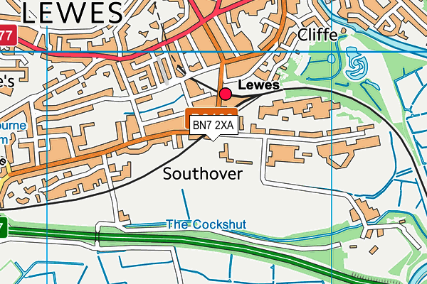
Lewes Fc (The Rookery 3g) on a map

Lewes Fc (The Rookery 3g) geodata
| Easting | 541713.82 |
| Northing | 109441.84 |
| Latitude | 50.867119 |
| Longitude | 0.012499 |
| Local Authority Name | Lewes |
| Local Authority Code | E07000063 |
| Parliamentary Constituency Name | Lewes |
| Parliamentary Constituency Code | E14000786 |
| Region Name | South East |
| Region Code | E15000008 |
| Ward Name | Lewes Priory |
| Ward Code | E05011589 |
| Output Area Code | E00106866 |
About this data
This data is open data sourced from Active Places Power and licenced under the Active Places Open Data Licence.
| toid | osgb1000006876528 |
| Created On | 15th Oct 2006 |
| Audited On | 17th Feb 2023 |
| Checked On | 17th Feb 2023 |
